I worked two shows of the Beauty and the Beast Broadway in Austin show from the Bass Concert Hall over the weekend. The show was great. My favorite number was “Be Our Guest”; great music and great choreography, including tap.
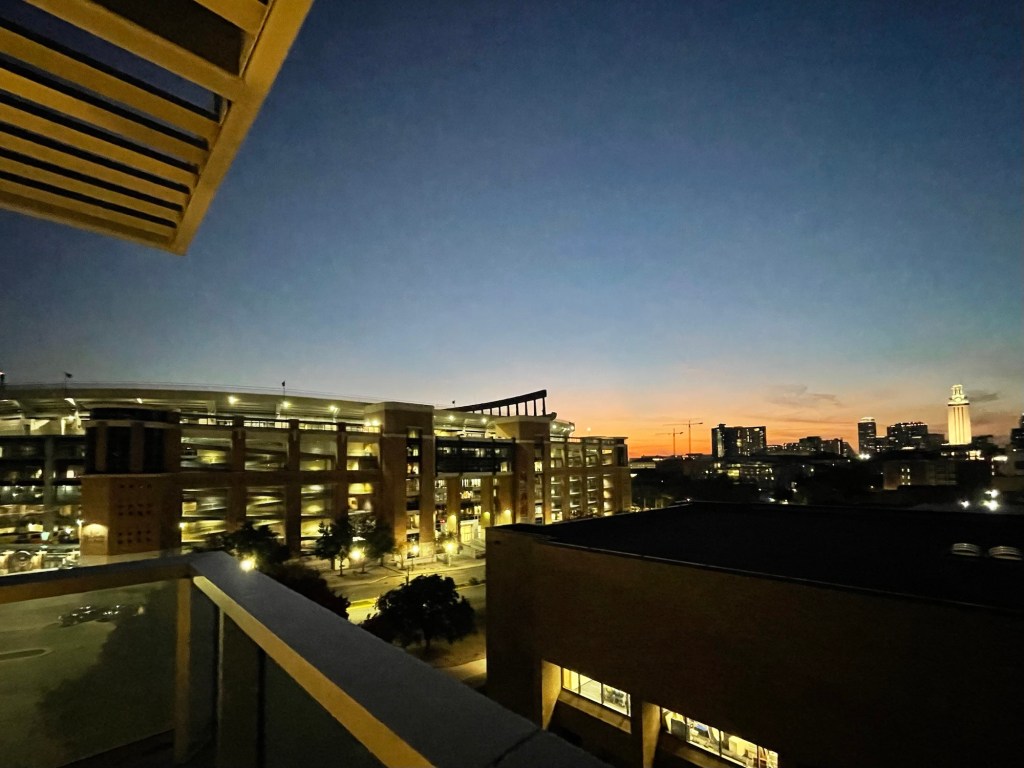
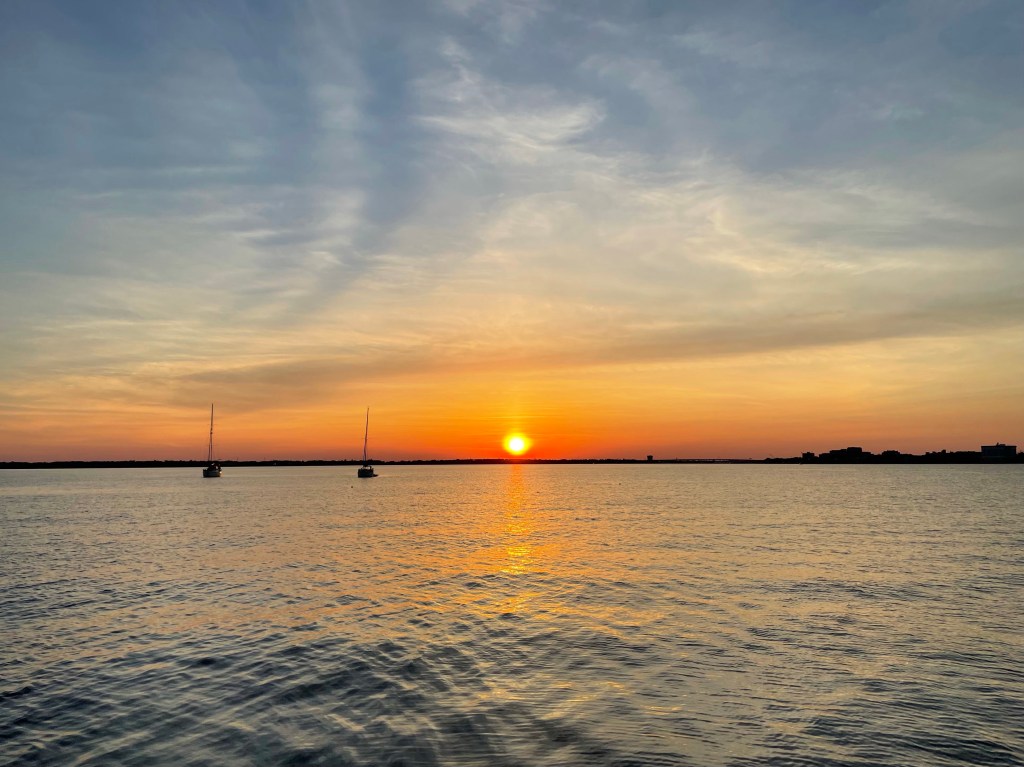
Between shows, I went up to the balcony on the 6th floor to see the post-sunset sky over the 40 Acres.
Looking to the west from the Bass concert Hall. Looking to the southwest; Texas memorial Stadium and the UT tower. Broadway in Austin!
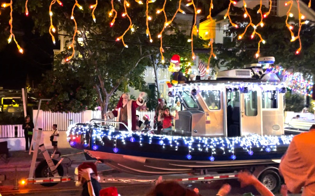
I just returned from a fun girls’ trip to Key West. The reason for the trip was to visit Dry Tortugas National Park. Mission accomplished. Here’s a peek at Key West in December.
We have driven by the Palo Duro Canyon State Park many times on trips to and from Colorado over the last 25+ years.
This week we took a little road trip to go see it. Palo Duro Canyon is the second largest canyon in the United States. It’s located in the high plains of North Texas; the Llano Estacado. The elevation at the rim is about 3500’ and the floor of the canyon lies about 800’ below. It is called “the Grand Canyon of Texas” and the steep, layered rock walls sure echo those of its namesake.
We took the 8-hour drive up and stayed in a cabin on the floor of the canyon that was built in the 1930s by the Civilian Conservation Corps.
Cow Camp cabin #4 – our little bit of paradise
The park is stunningly beautiful. Being in the heart of nature for a couple of days was unforgettable.
Sunrise at cow camp cabin #4Sunrise lighting up the canyon wallSunset view
The visitor center provided a nice introduction to the geology and history of the canyon.
One of the Texas Longhorn herd
And oh the stars! We sat outside for hours watching the sky.
Milky Way!And more Milky WayOrionMoonStar gazer
On the way home we made an overnight stop in Lubbock. We enjoy visiting the McPherson Cellars tasting room whenever we are in the neighborhood. We can always find another couple there to talk with over a glass of wine.
We stopped in lots of tiny Texas towns to check out their antique stores, historic county courthouses, and Main Street cafes.
I spied an old postcard in an antique shop that foreshadows a road trip that I just booked!
My main intent for this trip to Seattle was to see my 7 great nieces & nephews. ✅✅✅✅✅✅✅
I also spent some good time with all but one of my nieces and nephews, and my sisters. I got a chance to visit my friend Irene again. We surprised her mom who I last saw at our high school graduation too long ago. What a special treat.
The Pacific Northwest is beautiful. It never disappoints.
Sunset at Everett MarinaFog at Port Townsend harborPears at Rachel & Matthew’s homeSilver City Brewery in BremertonSmoky view across Hood Canal
Monte and I made a long weekend trip to Seattle to visit family – old and new. We have 3 new great-niece/nephew babies to meet, and my brother had a big birthday to celebrate.
The last time we were up in the Pacific Northwest together was 5 years ago. The last time all my siblings were together was over 4 years ago. So I was really ready for this trip 🙂
Mount Rainier viewed from the north
We visited the Museum of Flight just north of the SEA airport. This was my first visit, and I would recommend it. It has one of the largest collections of aircraft on display. We flew a flight simulator and did a barrel roll. We walked through a Concord, a 747, a 787, and one of the Air Force One planes from the Kennedy, Nixon, and LBJ administrations. The space flight exhibits are great, too.
So many planes
After the museum, we drove to southern Washington to meet Byron, Rachel and Matthew’s 4-month-old baby, and my great-nephew.
Sunrise at Rachel & Matthew’s home
The next day, we booked it back up to North Seattle and stayed with Patrick and Nga. We had a nice visit and a great dinner. And as a bonus, both their boys were home.
Sunset over the Olympic Mountains, the beautiful view from Pat & Nga’s home
Saturday morning we made it to Noreen and David’s. We took the Edmonds-Kingston Ferry, popped into Poulsbo for coffee and a walk along the waterfront.
Saturday evening we had a party for Brian. It was wonderful to have all 5 of us siblings together again after way too long. We laughed way too much and enjoyed our time together.
On Sunday we walked around the woods in the morning, and watched the Seahawks game in the afternoon. Jared and Cass came over with their new twins, Nora and Viola, my great-nieces. I got to hold each of them for a while. They are tiny and precious.
The next day it was time to head back to the furnace that Austin is. On the way to the airport, we stopped in Port Orchard to see Fran’s kids, Rebecca and Aaron. They are 20 and 18 and each has a good plan for their futures. It was great to see them.
The only faces I didn’t get to see were Neil, who is working 12-hour days, 7 days a week for the next few months, and Julie, who is in Denver. But other than missing them, it was a perfect visit. ❤
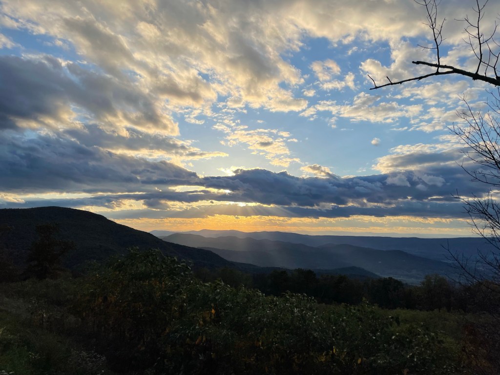
We left Annapolis yesterday, driving home to Austin. Our route takes us very close to four US National Parks along the way. So, we must see them!
Sunday’s park was Shenandoah National Park. It was the created in 1935 amongst the Blue Ridge Mountains. The winding, two-lane Skyline Drive takes you through the park along the ridge-tops with dozens of overlook parking areas along it. We drove it for 60 miles. The trees were turning red and gold. It will be even more stunning in a week or two.
We rafted up overnight with Julie and Ryan last night, grilling up dinner once they tied up to us after sunset. It was a new moon night, dark and clear.
The only other boat in the cove with us, as we enjoyed the sunset.
The temps were perfect, but no wind overnight.
Thankfully the winds came up around 10AM this morning and Monte and I enjoyed a lovely sail up to the yacht club and back.
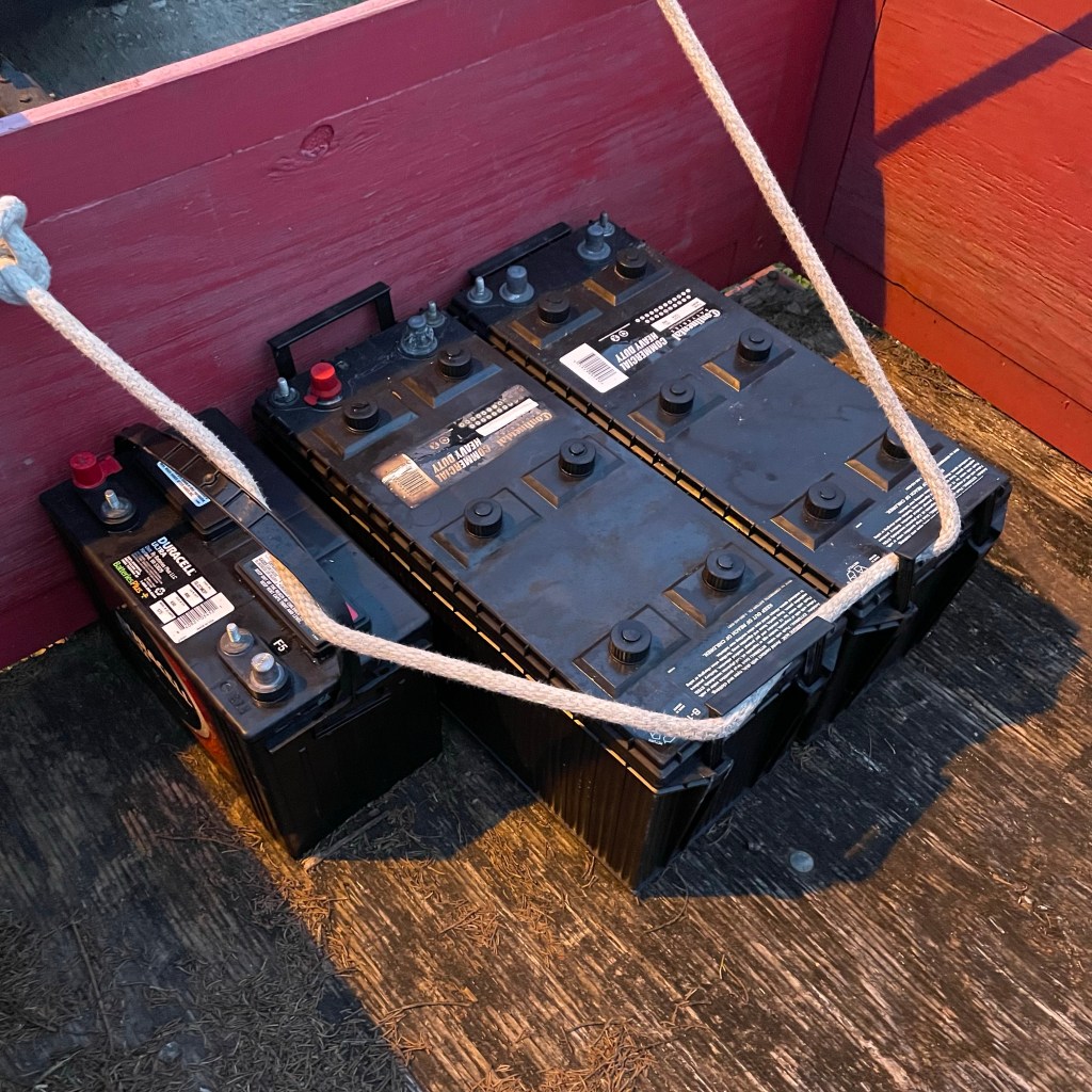
Last week was busy. We rescued Nirvana from the boatyard, brought her home, and I spent the next few days schlepping 100 lb batteries up and down the ramp, and Monte made sure they worked. The old ones lasted 5-6 years. The new ones will hopefully perform similarly.
Out with the old. One starter battery and two house batteries. The big ones weigh 100 Lbs each. She’s back home and shiny!
We got everything installed in time to race the beer-can regatta on her with Kurt and Kevin and she flew with her new bottom. We think she’s at least a knot faster.
Then over the weekend we anchored in the cove for a sunset grilled dinner. Nice. Very nice. We had our annual first jump in the lake, finally, a week or so past the usual Memorial Day dip. It was fantastic.
We left Seabrook, South Carolina, on Sunday morning, taking the ICW to Charleston. We spent an hour or two getting fuel and a pump out, and then picked a spot in Charleston Harbor to anchor for the night.
Sunset at Charleston Harbor
Monday morning we left at first light, headed for Winyah Bay. We sailed on the outside with wind pretty close on our nose. We anchored near Georgetown Light.
Today, Tuesday, we are opting to stay at anchor for another day, as the weather offshore will be more favorable for where we want to go. The wind should shift from the NE to the East tomorrow making it easier to sail on a NE heading.
We’ll leave tomorrow for an overnight to Cape Lookout. More later.
Most years I post a summary of the previous 12 months here on Sheila365 – summarizing moments from fun trips, visits from friends and family, and other adventures and highlights from the year (like these summary posts from 2019 and 2018). Unfortunately, on this last day of 2020, there isn’t much to report, as COVID has curtailed most highlight-worthy moments.
Instead, today I went back and looked at my first post from the beginning of 2020. In that post, I included a picture of a beautiful sunrise that I took the previous year – as we were at the dawn of a new decade. I had to chuckle and shake my head reading this statement a year after I wrote it: “I’m not sure what the next ten years will bring, but I’m ready.” Well, I can now say that I was in NO WAY ready for what 2020 would bring.
BUT, I am still here, as are my loved ones, thank God. So, I am grateful, and I am simply trying to roll with it.
To end the year, I will just leave you with this, a picture of a beautiful post-sunset scene that I took at anchor in the Ashepoo River in South Carolina. Tomorrow is a new day.
I grilled pork tenderloin for dinner tonight. Over charcoal. Marinated in Allegro. Indirect. 21 mins, ~7 mins per side. Measure with meat thermometer to 145 degrees F. AMAZING.
As I waited for the meat to grill, I snapped this photo of the not-quite-full moon over our winter foliage.
I grilled a delicious cedar plank salmon for Christmas dinner, recipe below. Julie joined us and stirred up a tasty risotto dinner. Nom nom. Sunset was fleeting, but lovely.
Grilled cedar-plank salmon:
soak a cedar plank in water for several hours ahead of grilling
slather a boneless salmon fillet with olive oil, then sprinkle generously with kosher salt, freshly ground black pepper, and a dash of garlic powder
place fillet, skin side down on the pre-soaked cedar plank
place cedar plank & salmon over direct coals for 20-30 minutes