
We enjoyed a slow day at the lake. Anchored in our spot and had the cove to ourselves by nightfall.

We enjoyed a slow day at the lake. Anchored in our spot and had the cove to ourselves by nightfall.
Monte and I joined 2 of my sisters, brother-in-laws, and 3 nieces/nephews for a weekend of fun on Lake Cushman. It sits just east of the Olympic mountains in Washington State. The lake temps were in the 70s and clear, sunny and in the 90’s above. Just beautiful. We kayaked, tubed, ran up the lake by motorboat, tried the rope swing, tent camped, played games, and just had a really great time together.


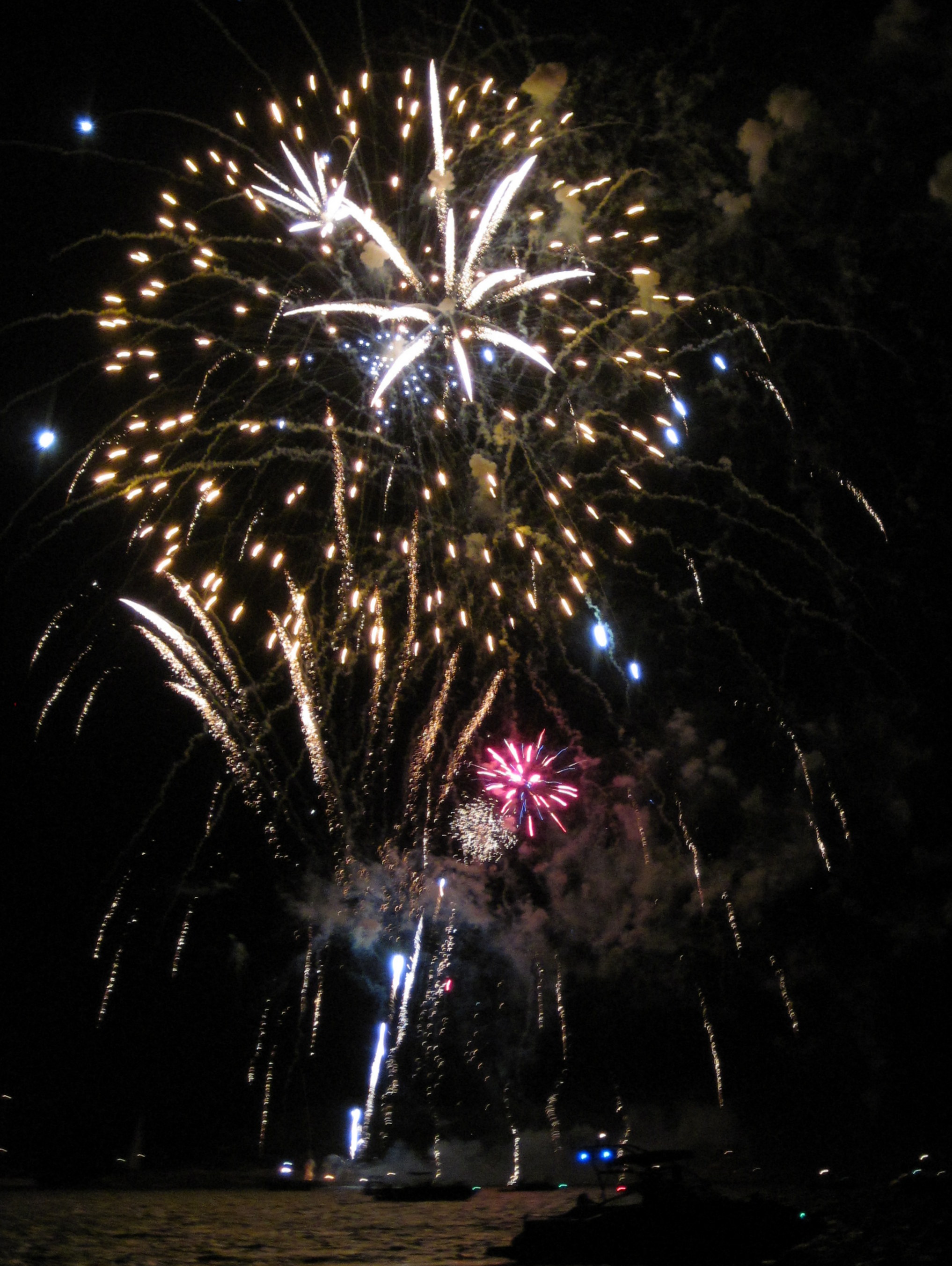
For the last week and a half, Monte and I hosted his family’s bi-annual reunion. We started out with a big 3-day weekend, enjoying reconnecting and having fun at the house and in the backyard with 21 of our relatives that came from pretty much every corner of the country. Then, for the next week, ten of the family that could stay longer came to stay with us at the house. We packed it with as much food and fun as we could. It was really a special, wonderful time. Sailing, floating, grilling, cornhole, homemade pasta, bimini ring game, barbeque, card games, homemade pizza, geocaching, karaoke, low-country boil, gardening, sno-cones, sightseeing, even taking part in our neighborhood’s 4th of July parade. Over the last few days, our party dwindled until it was just four of us yesterday. We set out for the lake and sailed to Starnes Island to anchor up and watch the fireworks show. It didn’t disappoint. We squeezed every bit of fun out of the time spent with everyone.
Today we said goodbye to the last two revellers. It’s just our flock now. The house is quiet.
I leave you with two shots from the fireworks last night — here’s to family!

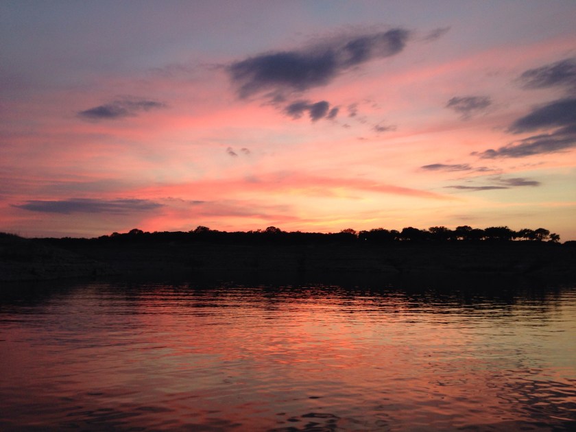
A glimpse of the beautiful sunset last night.

Today the lake is lapping close to 665′. How amaze-balls is that??!!! The forecast has settled down enough for us to plan a night out. And it is amazing. The lake is up 45’+ and we are anchored up in a cove we could only look at on maps 2 weeks ago. Thank you!  Kurt & Kevin joined us a little while ago. Who else is in?!!
We headed out to the lake yesterday. The rains have FINALLY been falling over the basin that flows into Lake Travis. We have been watching the LCRA lake levels like kids in a candy store. The lake is up to over 648′ today! which is up about 25′ from where it has been stuck for the last few years. We still want more – 30 more feet and brimming would be nice – but boy was it thrilling to see. I actually felt my heart rejoice. 🙂
The band of grey, exposed limestone is thinner now. Sometimes Islands are islands again! I’m glad I spent one afternoon walking the length of the peninsula while it was exposed earlier this year.

Our marina has moved half of its dock back to shore. All of the ramps for the letter docks are floating. And one of our boat ramps is usuable again. We went for a sail with Kurt and Kevin. We saw alot of debris in the water. And alot of these….. balls of red ants floating in the lake. Beware folks, you do NOT want to swim into one of these!

We anchored in our cove and spent the afternoon marvelling over how great it was to finally have our lake back. 🙂
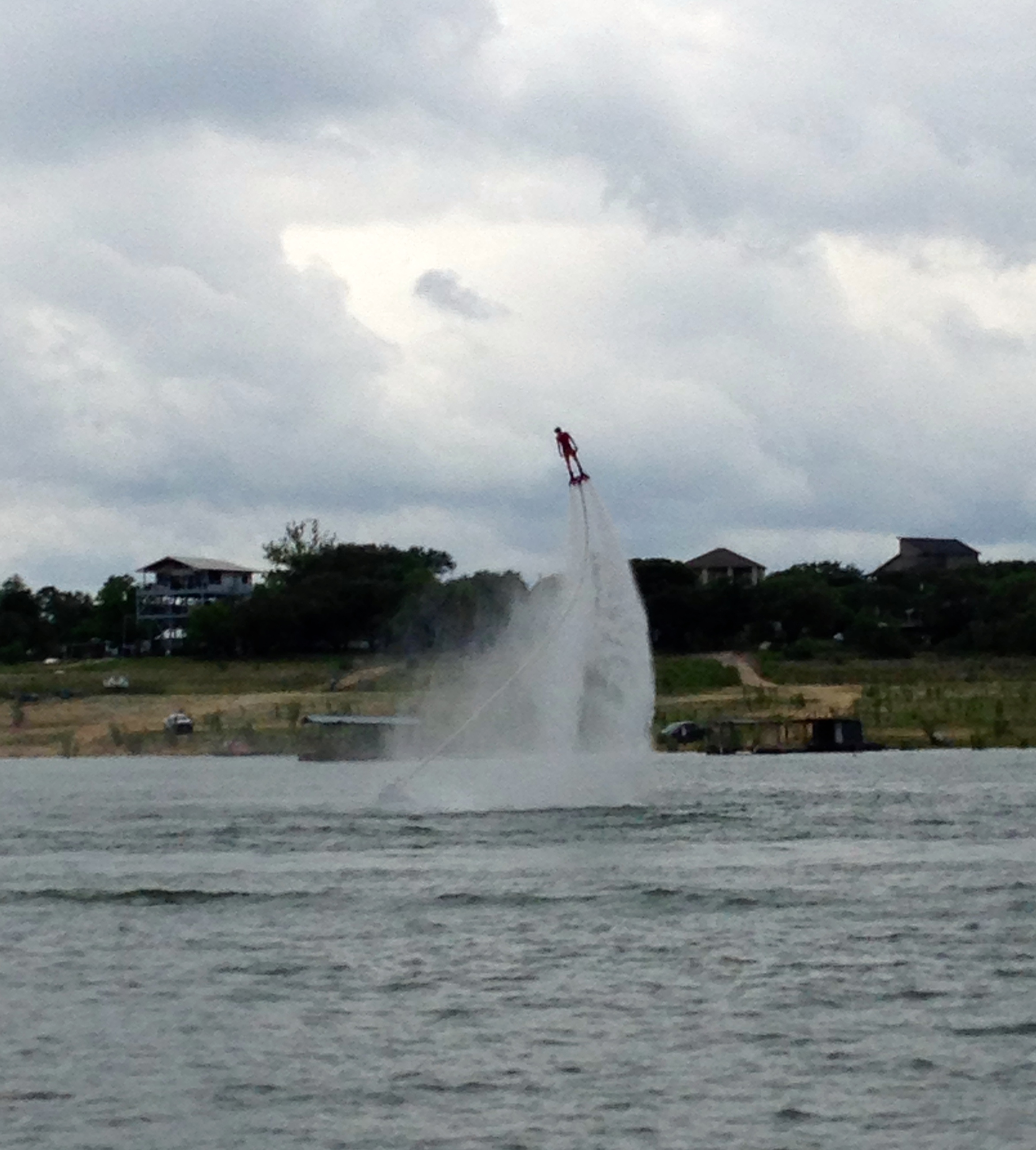
Oh, and…. i want one of these:
We enjoyed a lovely night on the hook. We cooked up some grilled red peppers, chicken poblano sausages and rice.
We’re spoiled now…used our phone as a wireless hotspot and then streamed shows off of amazon prime on TV down below until we both fell asleep. Not exactly roughing it. 🙂
This morning I paddled for quite a while then went ashore to scrub 6 months of gunk from the bottom of the kayak. I also checked on some geocaches I’d hidden nearby. All good.
Pretty sights: 

Tonight Kurt will join us for another night in the cove. An almost full moon should light things up.
We hightailed it out of town after work. The sunset from the back deck:

We headed to the lake today. A lovely sail and then anchored out with Kurt & Kevin on Dancer.
Sunset:
Dessert (pie, get it?):

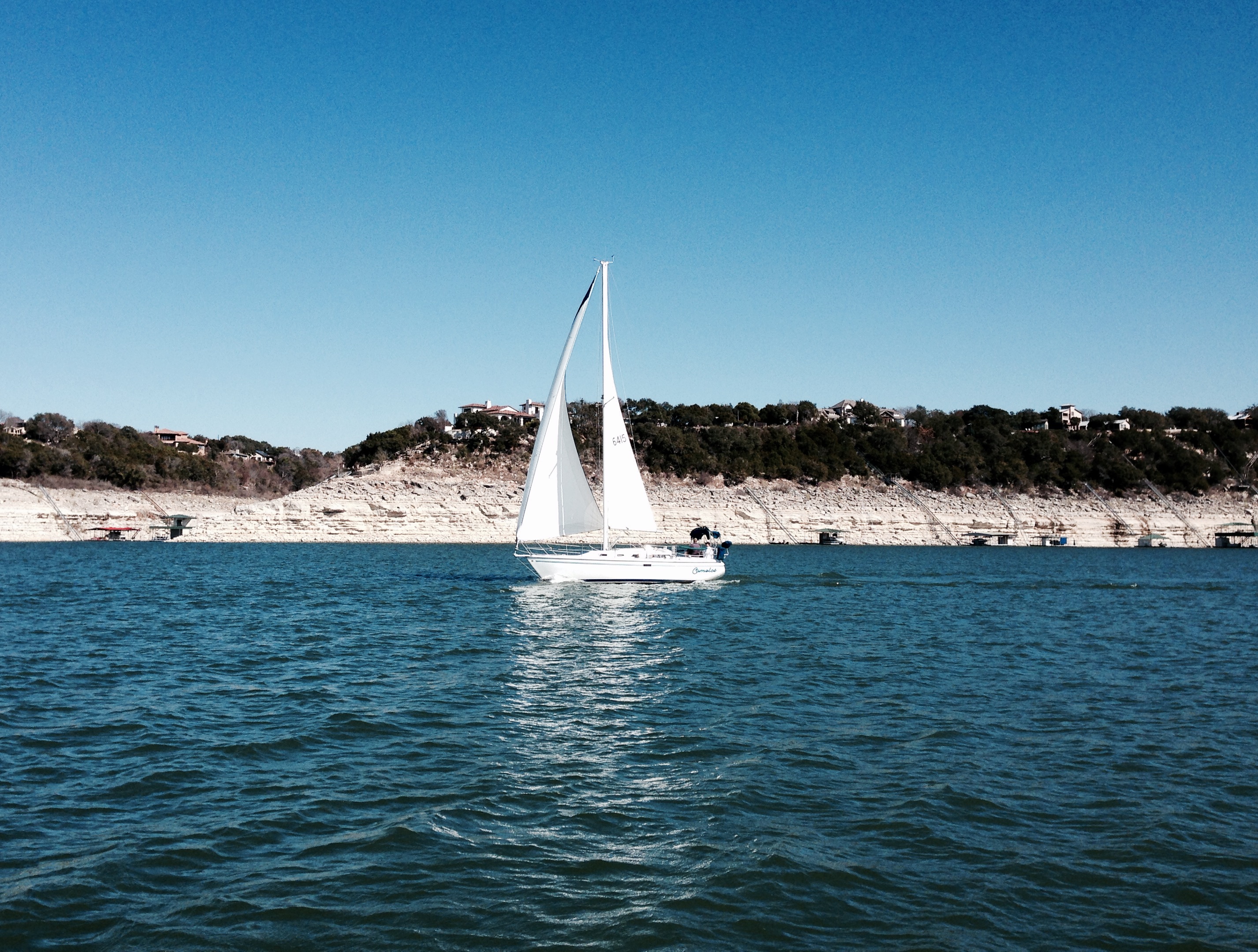
We headed to the lake Saturday for a sail and to anchor out overnight with Camelot. It was a gorgeous day! Winds 10-15. High in the low 70s.
After a lovely sail past Starnes Island and back, Camelot radioed that their engine would not start. Roh roh. Change of plans. We sailed back to the marina ahead of them. The winds were much lighter now and straight out of the cove, which made it possible for Camelot to sail slowly up to a side tie on the end of the far dock – where they could then just loose the sheets. We met them at the end of the dock to push them off and grab their dock lines. Exciting, but well planned and executed. Camelot will remain there to get worked on next week.
We ended up just spending the night in the slip. But a very lovely night it was.

One of many familiar images of Austin is of the Pennybacker Bridge at Loop 360, overlooking a stretch of beautiful Lake Austin. The 360 Loop drive and its Hill Country views are one of my favorite parts of Austin. I crossed off one of my must-do’s by hiking up the cliff overlooking the bridge to take in the view for myself. In the panorama above, you can just see the downtown skyline peeking over the hill on the left of the image. I’m not afraid of heights, but I have to say my heart skipped a beat or two as I stood on the rock on the edge of the cliff.
For reference (from google streetview):

I think I like this shot better. It’s taken from a vantage point slightly farther west, down the trail along the top of the cliff.

Just another gorgeous day in my little corner of paradise.
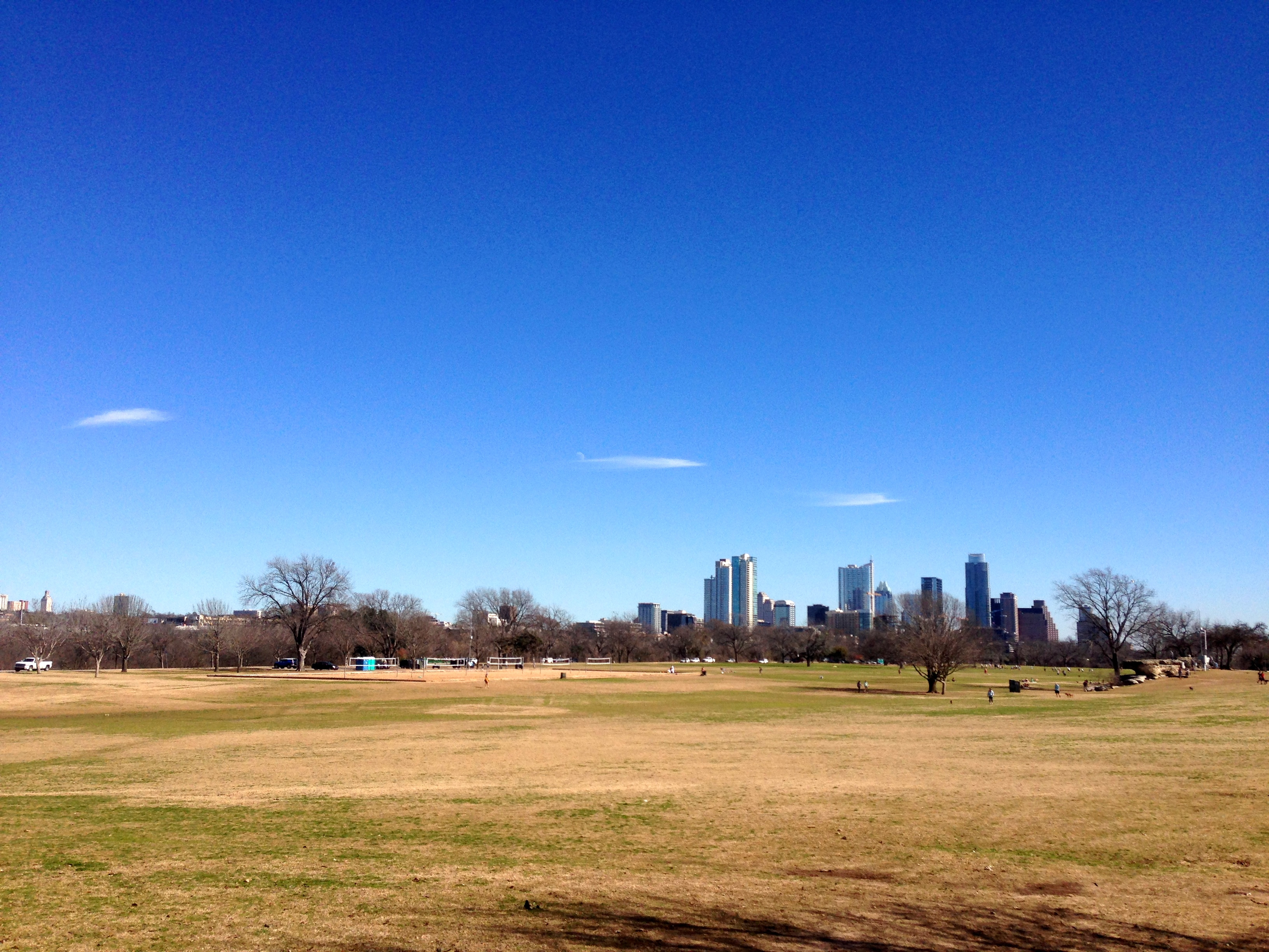
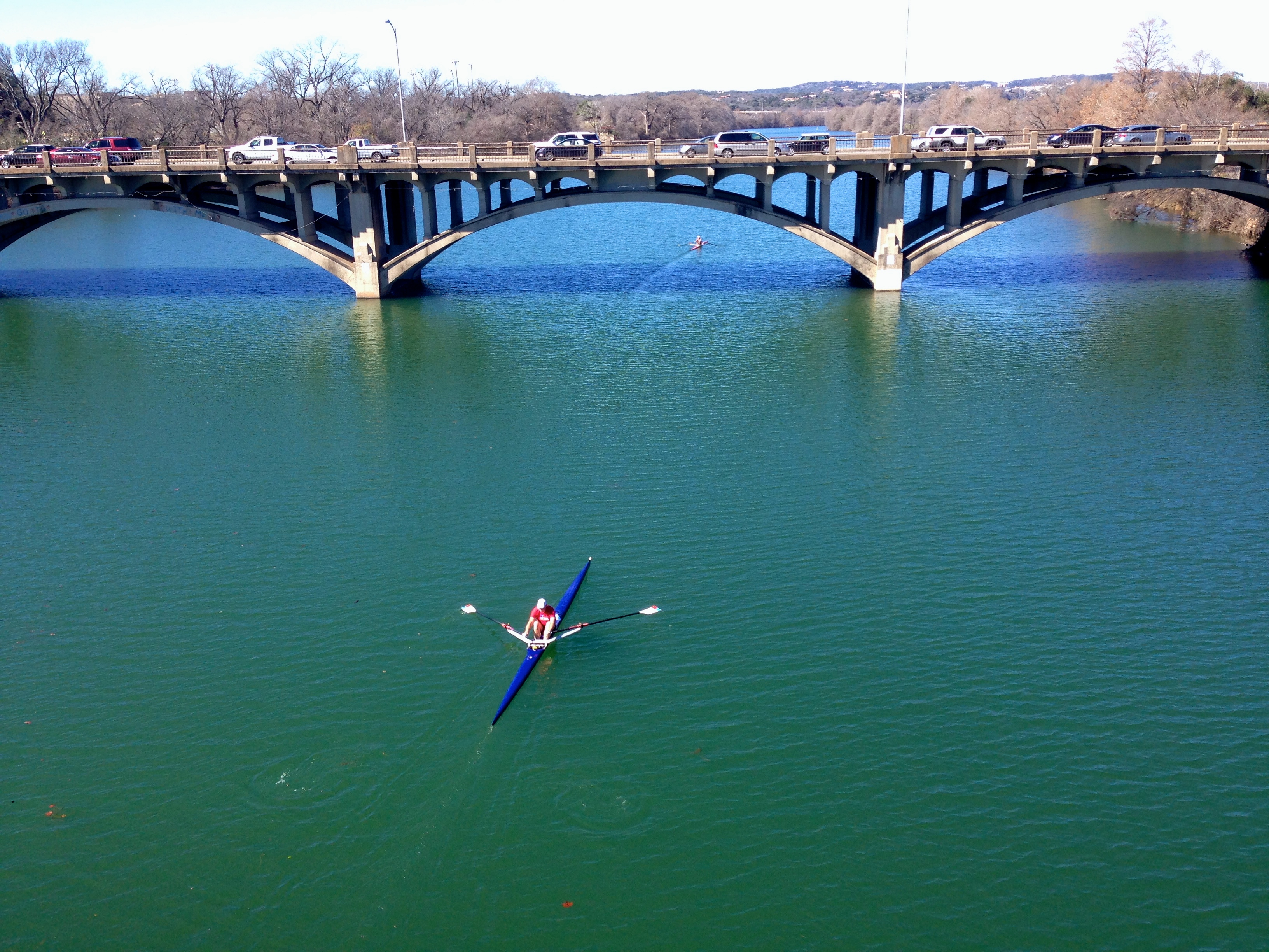
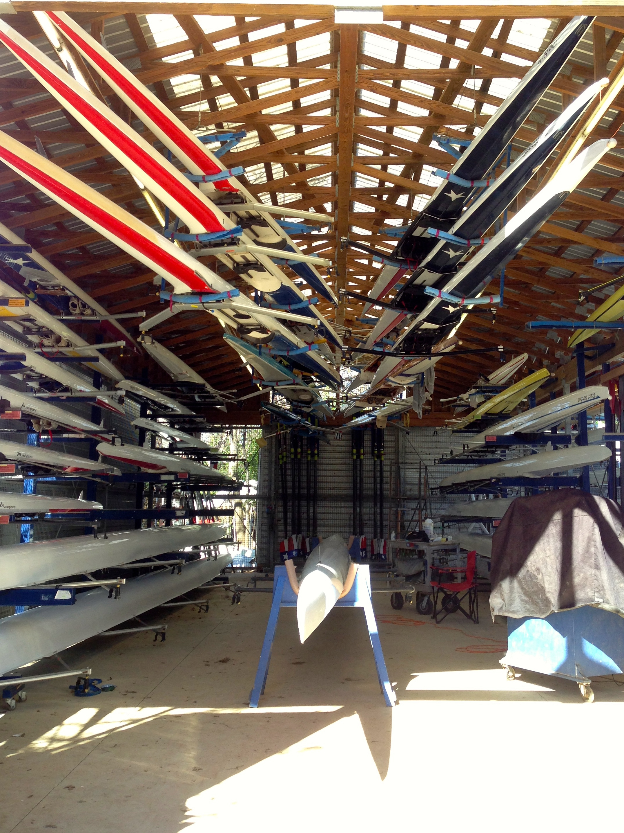
I know that my friends in the Northeast have been hit by a snowstorm today. But what a BEAUTIFUL day here in Austin! The Butler hike and bike trail around Town Lake (oops, i mean Ladybird Lake) is always a nice destination, with loops of varying distances depending on which bridges you choose. Last year the boardwalk on the southeast side of the lake was completed. I set out today to walk the Mopac / I35 loop. The Butler Hike and Bike Trail maps say that loop is 6.9 miles, but I must have dilly-dallied, because I logged a bit more.
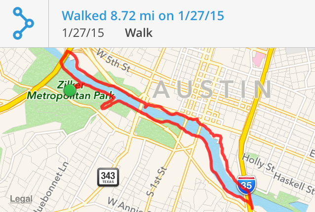
It was a simply lovely day. I leave you with a few pics from my lap:


I would love to be able to come down here every day.
This weekend has been a glorious January one for the books. Yesterday we kind of got rat-holed by what should have been a 30 minute project at the house, but it ended up consuming the day.
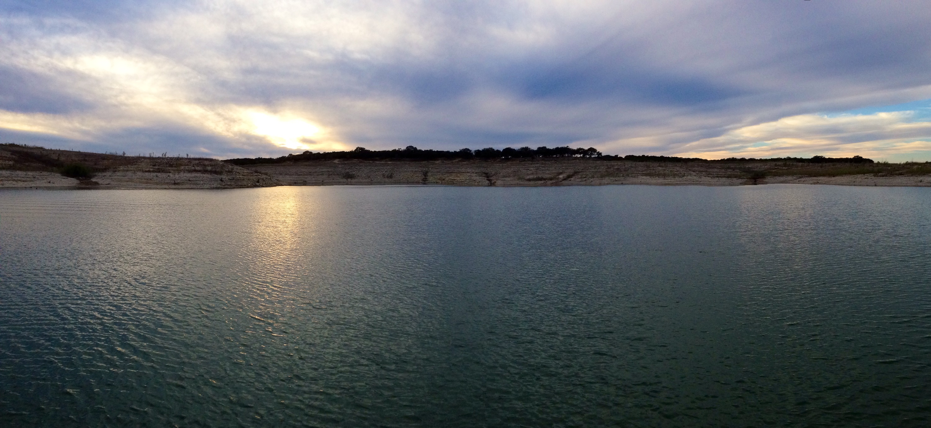
Today, however, i was determined to get outside. The level of Lake Travis continues to remain woefully low at 624′ above mean sea level. Happily, though, the rain from last week raised the level about 9 inches. We just have another 684 inches to go before the lake is full!
One of the features of the land that surrounded the original river that the drought has uncovered is the piece of land referred to by locals as “Sometimes Islands.” When the lake basin is flooded, the peaks of this piece of land sometimes stick up; sometimes they are covered by water. Well, for the last 3 or 4 years, Sometimes Islands has become For-the-Foreseeable-Future Peninsula.
We set out today to walk the length of the peninsula. So we packed a few snacks for lunch, brought our GPSes, and tossed my Christmas present from Monte – a metal detector – in the trunk for its maiden voyage.
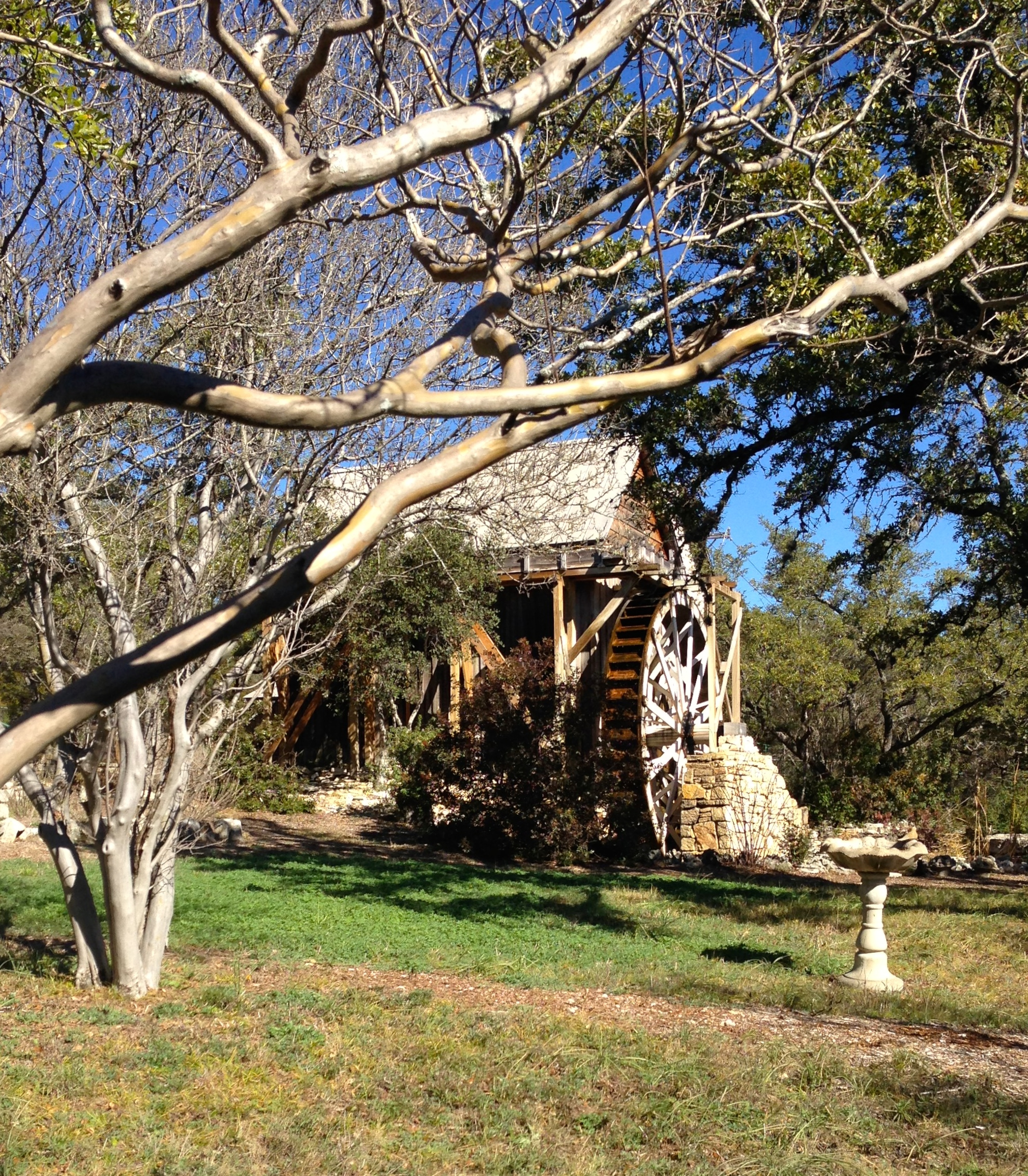
We stopped briefly at the historic site for the original Anderson Mill – the mill that operated near Cypress Creek in the 1800s – a NW Austin neighborhood and road still bear its name. They have a museum here as well, but it is only open for a few hours on the 4th Sunday of every month between March and October. We’ll have to come back for the tour.
Then we headed for Mansfield Dam Park and started our trek.

This is the old highway that used to cross over the top of the dam. It is closed to ordinary folks these days, and Highway 620 is the throroughfare now. I’d love to get a chance to stroll across the old road now, though.
I walked the length of the peninsula – about 2.5 miles out from the park – and found all the geocaches that didn’t require scuba gear. Monte marked a couple of points on his GPS that will hopefully be boating hazards and/or navigable cuts once again at some time in the future. This was the view from the park looking out over Sometimes Islands…the structure on the top of the hill in the center of the picture is the Oasis.
 We also tried out the metal detector for the first time. And I have to say: “Pretty nice!” We were able to detect and reliably find nearly every piece of metal (aluminum, lead, iron, steel, …) that it sounded on, even if we had to dig 6″ or more to get to it. I’m looking forward to bringing it along on some of our cove-explorations when the weather gets warmer. No treasure this time. But it was fun.

I go back to work a week from tomorrow. This weekend was a nice adventure. I’m hoping to squeeze in few more next week.
It’s a beautiful Saturday. Temps in the high 60s for a change. We are anchoring out in our cove.
We have the place to ourselves.
Tutti a tavola e mangiare!

And for dessert: HOT BUTTERED RUM!
Cheers!

We tried Emeril’s recipe and it was just right!
