We have driven by the Palo Duro Canyon State Park many times on trips to and from Colorado over the last 25+ years.
This week we took a little road trip to go see it. Palo Duro Canyon is the second largest canyon in the United States. It’s located in the high plains of North Texas; the Llano Estacado. The elevation at the rim is about 3500’ and the floor of the canyon lies about 800’ below. It is called “the Grand Canyon of Texas” and the steep, layered rock walls sure echo those of its namesake.
We took the 8-hour drive up and stayed in a cabin on the floor of the canyon that was built in the 1930s by the Civilian Conservation Corps.
Cow Camp cabin #4 – our little bit of paradise
The park is stunningly beautiful. Being in the heart of nature for a couple of days was unforgettable.
Sunrise at cow camp cabin #4Sunrise lighting up the canyon wallSunset view
The visitor center provided a nice introduction to the geology and history of the canyon.
One of the Texas Longhorn herd
And oh the stars! We sat outside for hours watching the sky.
Milky Way!And more Milky WayOrionMoonStar gazer
On the way home we made an overnight stop in Lubbock. We enjoy visiting the McPherson Cellars tasting room whenever we are in the neighborhood. We can always find another couple there to talk with over a glass of wine.
We stopped in lots of tiny Texas towns to check out their antique stores, historic county courthouses, and Main Street cafes.
I spied an old postcard in an antique shop that foreshadows a road trip that I just booked!
I’m happy to report that things are picking up in the travel department. Before COVID we happily welcomed regular visitors to Austin and made our share of trips. Four years later, it’s feeling a bit more normal. We took a trip to Denver in January. Noreen and David visited us this Spring. I did a girls’ trip to Santa Barbara. Monte made a guys’ trip to the BVI. We flew up to Seattle in June. Laura came for a visit at the beginning of July. Last week we finished a road trip to see family and National Parks in the midwest.
Monte and I took the Subaru on another road trip. 3000 miles. 8 days and 7 nights. 9 states (well 10 if you count passing through the corner of Oklahoma, Missouri, and Kansas – aka OKKAMO). Made my first-ever visit to a Great Lake. Earned 3 new geocache state badges. Visited four more National Parks, bringing my total to 30. Still lots more to see.
It is nice to reflect that this year alone we have had in-person visits with all of our siblings, most of our nieces and nephews, and even a few grandnieces and nephews. What a treat.
Gateway Arch NP was much more interesting than I expected. The construction of this monument was an engineering marvel at the time, and it is MUCH bigger than I imagined. We took the tour up to the top, and even the tram system was an interesting innovation to learn about. The view from the top was amazing. I was a tiny bit freaked out to look out the window and see both feet of the arch below us(!)
View from the top of the Gateway Arch. The muddy Mississippi River to the east is at the top of this pic.
Indiana Dunes NP was a lovely stop for about 4 hours. We tootled by the homes from the Chicago Worlds Fair in 1933 that have been moved to the lakeshore and are now privately owned and lived in. We scored an amazing parking spot by the beach. And we walked up and down the beach, which did have dunes, but lots of rounded rocks. I waded into Lake Michigan, another first.
The south shore of Lake Michigan. No sea glass was to be found.
Cuyahoga Valley NP was a highlight for me. It commemorates the Ohio and Erie Canal system, with locks, and a tow path for the mule-pulled canal boats. The canal was dug by hand in the early 1800s. It was fed with water from the nearby Cuyahoga River, and carried goods between the Ohio River and Lake Erie, putting Ohio on the map for commerce and transportation. The canal isn’t operating anymore. It was wiped out by floods in the early 1900s and eventually made obsolete by the railway built alongside it. But its footprint is clearly visible and the miles and miles of tow paths make for amazing walking and biking trails. The park is located between Cleveland and Akron and I expected it to be an urban park, but it is in the middle of beautiful forests and hills. It is spread out, so do your research beforehand to pick from the many spots you may want to visit.
We spent 2 half days there, starting at Boston Mills Visitor Center, then visited Brandywine Falls, and the Everett Covered Bridge, walked along the towpaths, stopped in Peninsula to check out the town and to visit Lock 29, and made a visit to the Canal Exploration Center, which helped us to understand the whole canal operation and its history. They have rebuilt a working lock there to demonstrate how they worked.
I’m envious of the people who have this park in their backyard. It’s a beautiful place to get out and explore. If I ever make it back, I’ll bring a bike. And take a ride on the Cuyahoga Valley Scenic Railway.
Brandywine Falls @ Cuyahoga Valley National Park
Everett Covered Bridge @ Cuyahoga Valley National Park.
A rebuilt, working lock at the Canal Exploration Center @ Cuyahoga Valley National Park.
Mammoth Cave NP. Having driven by this park probably a dozen times, it was time to make a visit. We took the Historical Tour – a 2-hour, 2-mile, guided tour that took us through the cave at numerous levels of its 400′ of depth. It is different from other caves I’ve visited – a “dry”cave – in that it doesn’t drip water from the surface. So, no stalagmites nor stalactites. Rather, the maze of caverns has been cut from adjacent rivers that flow through the cave. It was amazing to experience a tiny bit of its vastness.
A view inside Mammoth Cave along the Historical Tour.
On this trip, we stopped in Rising Sun to visit Gary & Judy, Mary & Megan, and Bryan, and in Gobbler’s Knob to visit Susanne, Lanny, and Mica. We spent an afternoon making peach jam, and brought some home!
It was a great trip, indeed. I have already drafted our national park road trip for next year!
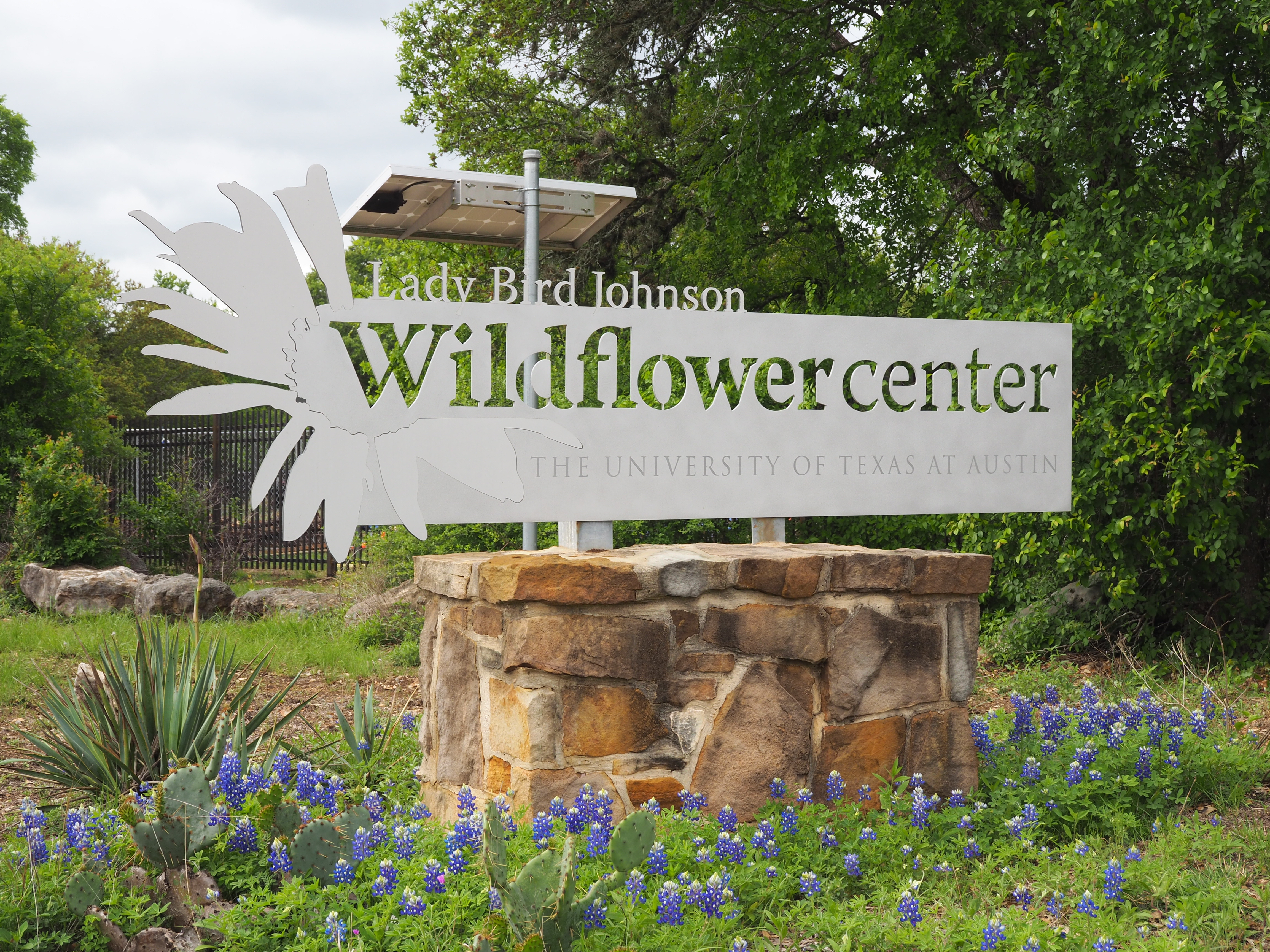
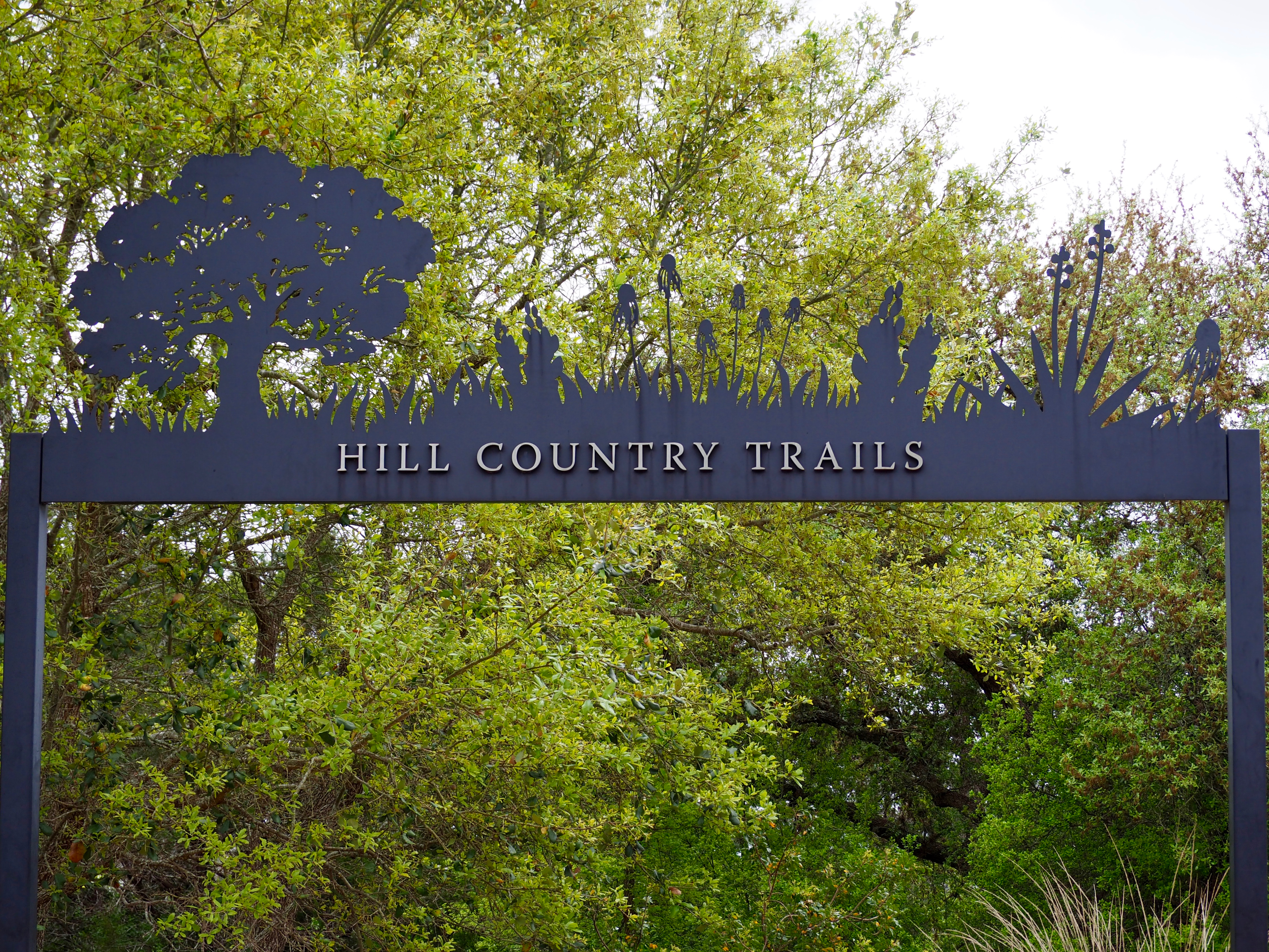
With no commitments until Easter dinner with Julie later in the day, we headed out to visit Lady Bird Johnson Wildflower Center. It is a beautiful place to see in the spring, full of gardens teeming with wildflowers, and several miles of lovely trails to explore.
I don’t think the wildflowers have peaked yet in south Austin, based on what we saw here, so there’s still time to get out there and see them!
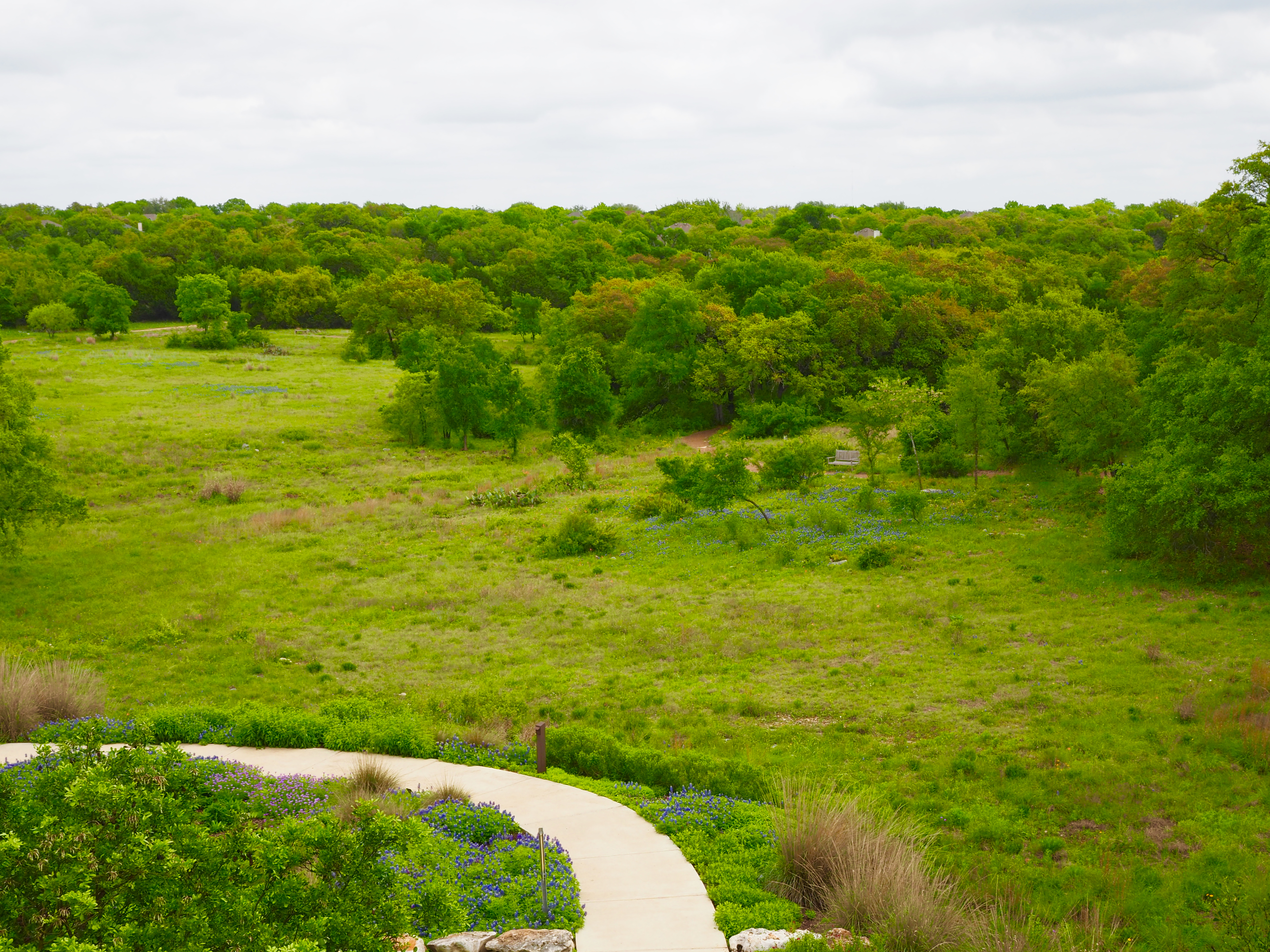
The view from the top of the cistern tower, overlooking the surrounding meadow trails.
There is a great-horned owl family roosting in a wall ledge just inside the entrance. There are two owlets, but they are not sticking their heads up in this shot.
I went birding and hiking today with my friend, Doray. We started early, at Reimer’s Ranch Park, and then did the guided tour of the canyon and grotto at Westcave Preserve. After that, we went back to Reimer’s to hike their River Trail.
Let me just say, “Whoo dogie, it was HOT!” Whew! 100 degrees or so. But it was beautiful, we did see lots of birdies, and we enjoyed a lovely day in our hill country. Pretty good day.
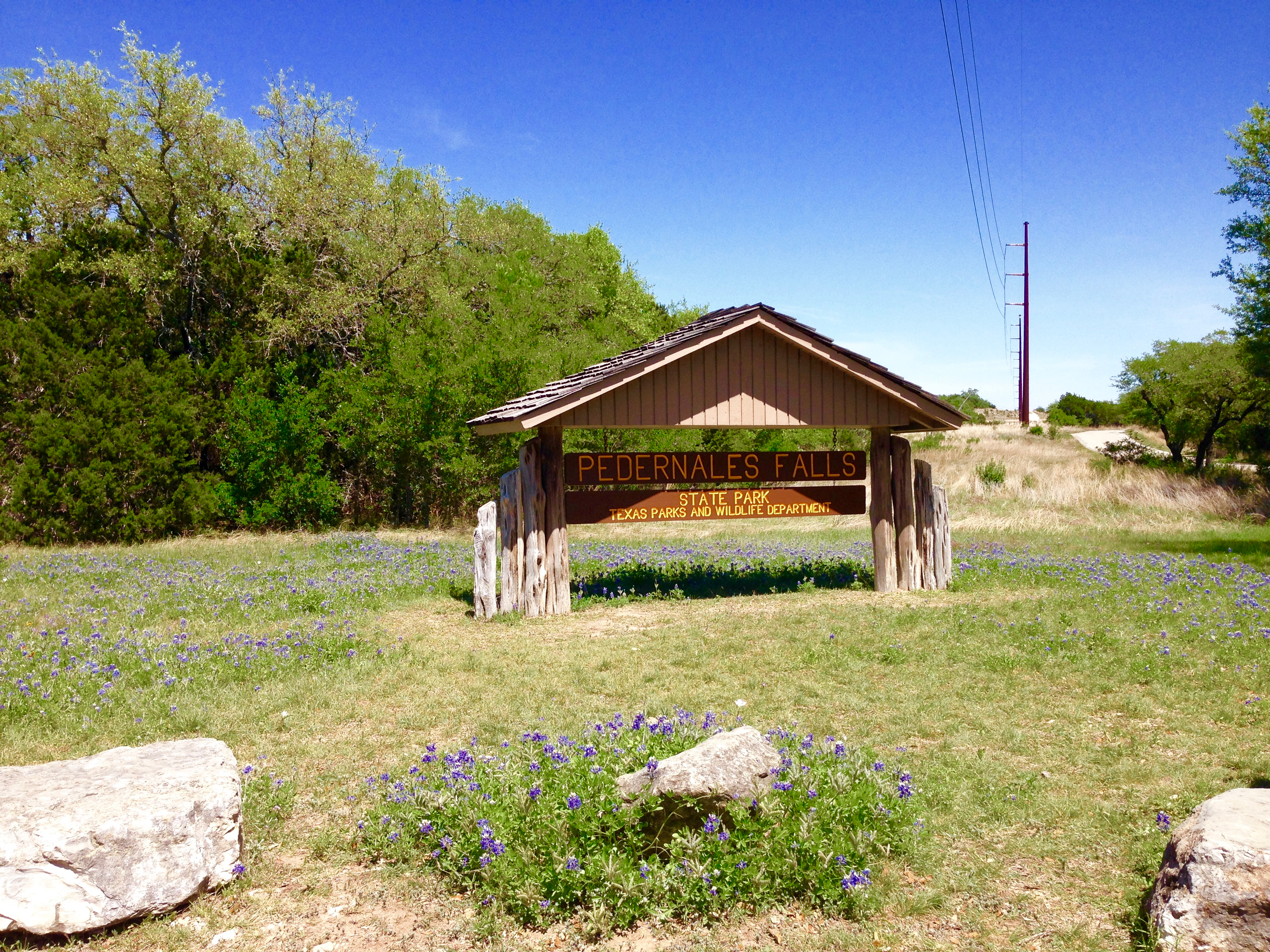
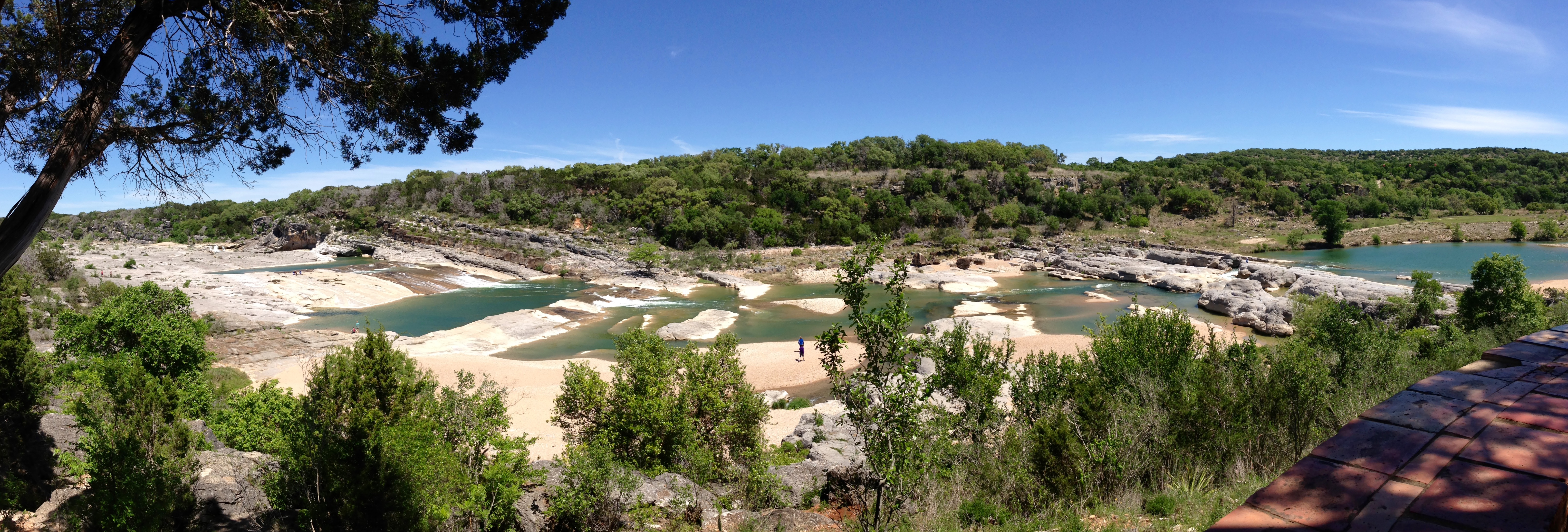
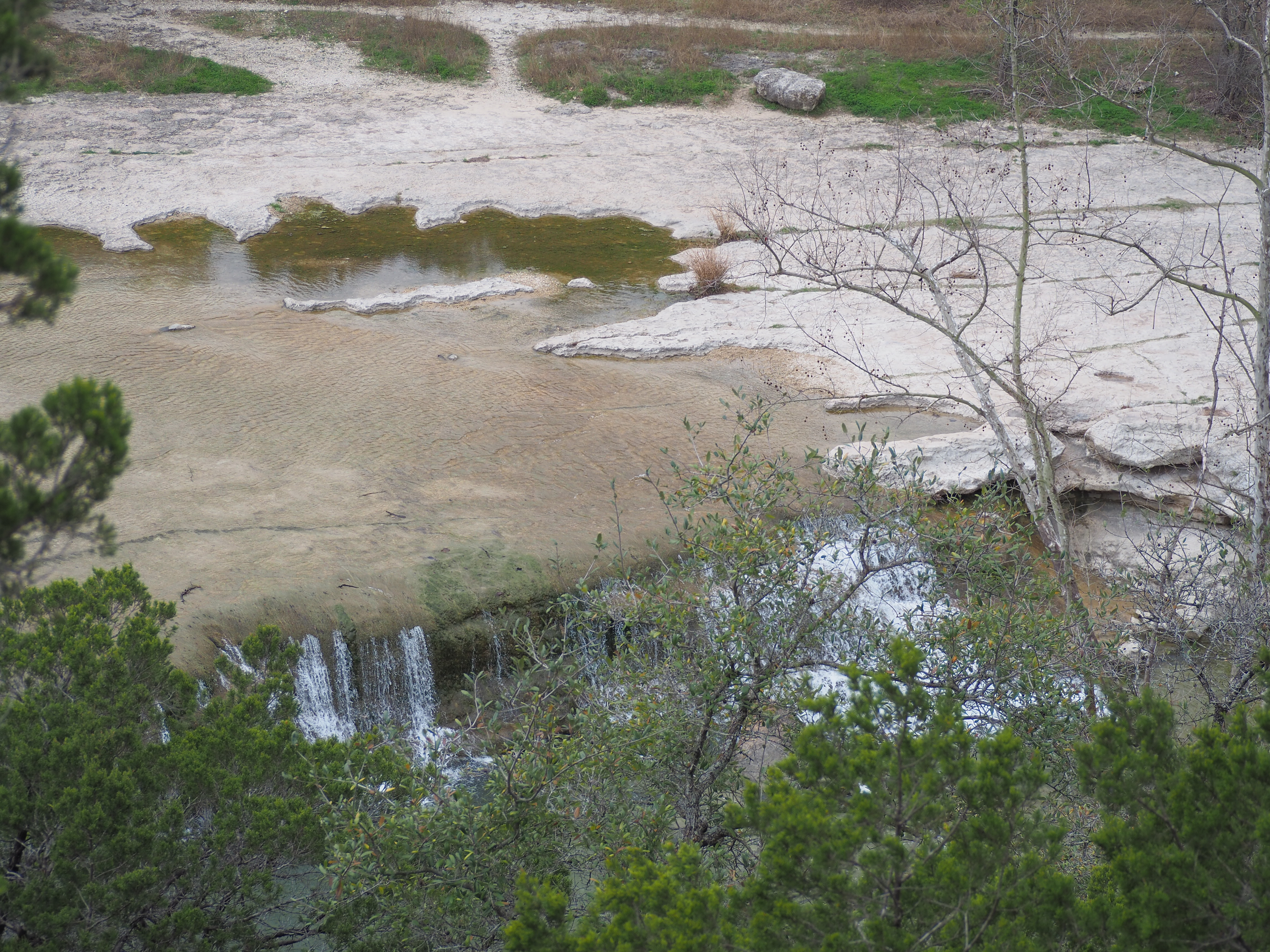
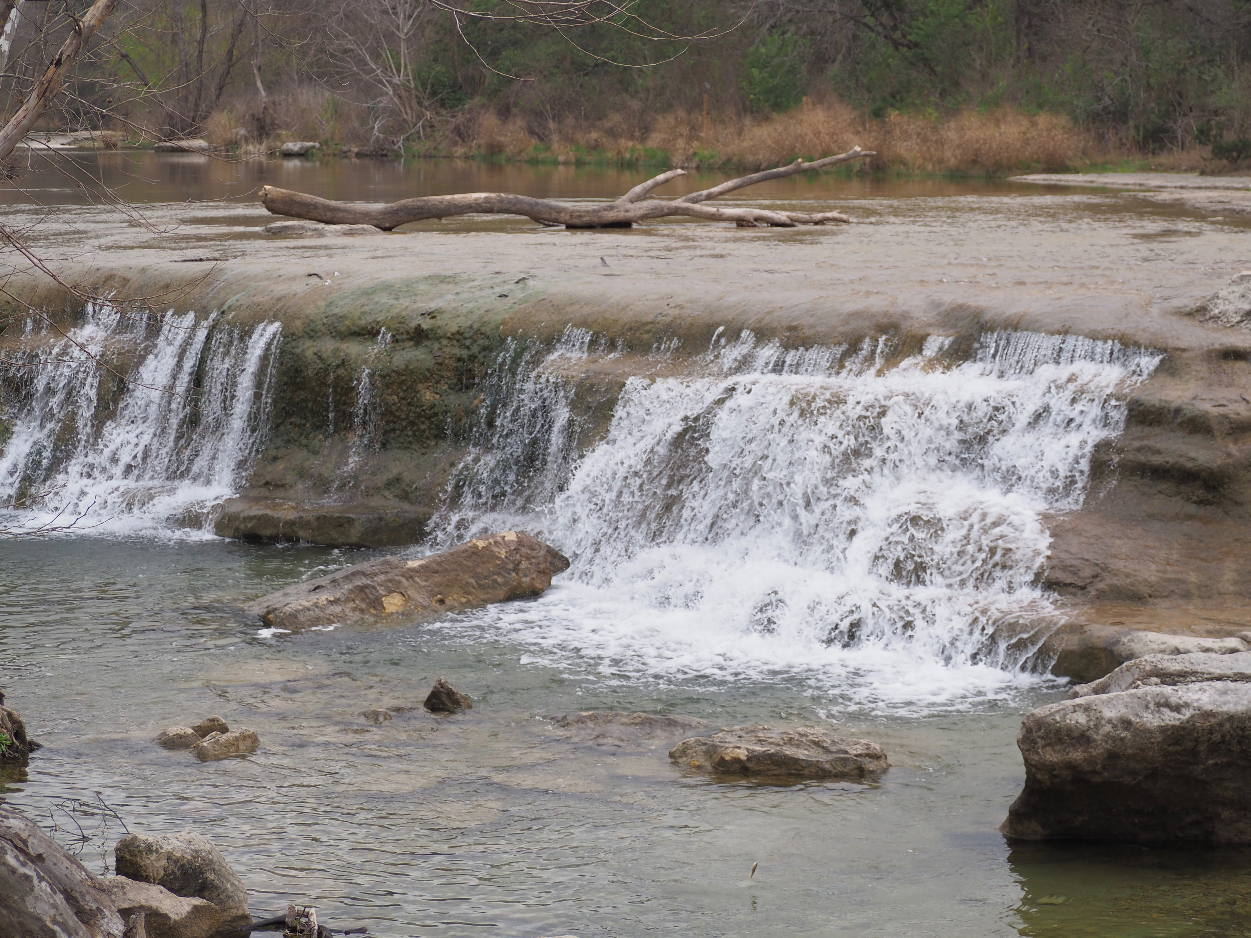
I went to Pedernales Falls State Park today to hike with a couple friends. They had never been, so it was fun to show them the different sights and trails.
We walked a bunch. After six hours or so, my Fitbit had logged almost nine miles. Whew!
If you hang around Central Texans long enough, you will learn that we are fond of bestowing our own pronunciation on the names of some of our favorite local places; confounding out-of-towners, I’m sure.
One of those place names is “Pedernales” – the name of a river, a series of water falls, and a state park. Take note: locals refer to it as “per-din-al-iss.”
Whether or not you can say it right, you must go see all three. I took a day trip and visited Pedernales Falls State Park today. I enjoyed visiting their bird blind, walking down to the Falls, scoping out birds while hiking, doing a little geocaching, and taking in the beautiful scenery on a gorgeous day.
I discovered a lovely park, right off Loop 360 and Spicewood Springs Road. The trail head for the Irving and Hazeline Smith Memorial Trail is on the northwest corner of the intersection. You can park right nearby. It’s an easy, flat, 1.5 mile loop through woods, grassland and near the creek. No dogs permitted, though.
Last weekend, I went for a 3-hour group hike with one of the biologists that does research for the City-of-Austin-managed Balcones Canyonlands Preserve. It was really interesting. We hiked a short loop along the preserve at Bull Creek. Along the way, I learned much about the native Ashe junipers throughout the hill country that I had previously come to detest, due to my annual cedar fever allergy symptoms. But I came away with a new appreciation for the tree and the role it plays in the ecosystem of the Balcones Canyonlands. I also learned about the other native grasses and shrubs that make up the understory of the woodland. And about the endangered golden-cheeked warbler that will soon make its annual trek from Central America in early March to nest in the woodlands of the preserve until returning south in July. I’m looking forward to more hikes out there. Stay tuned.
Bull Creek is flowing nicely since the drought has broken.
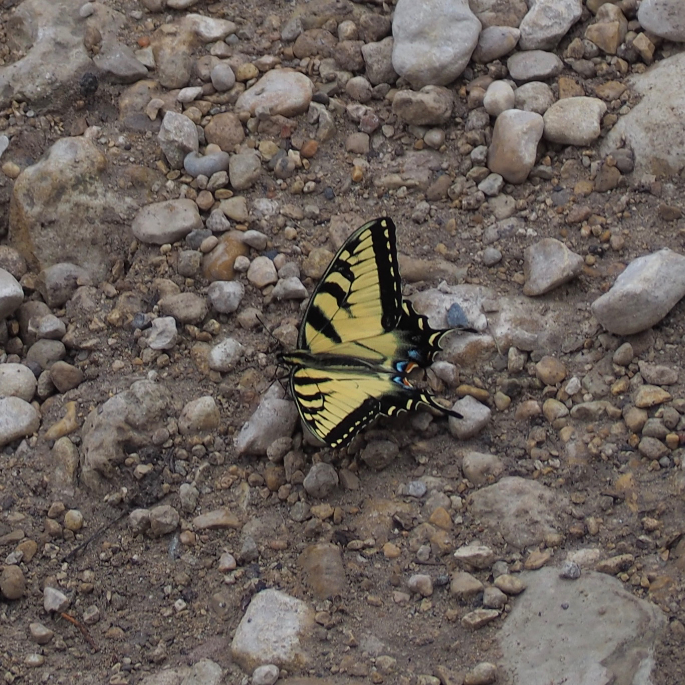
And, I caught a tiger swallowtail butterfly taking a break along the creek.
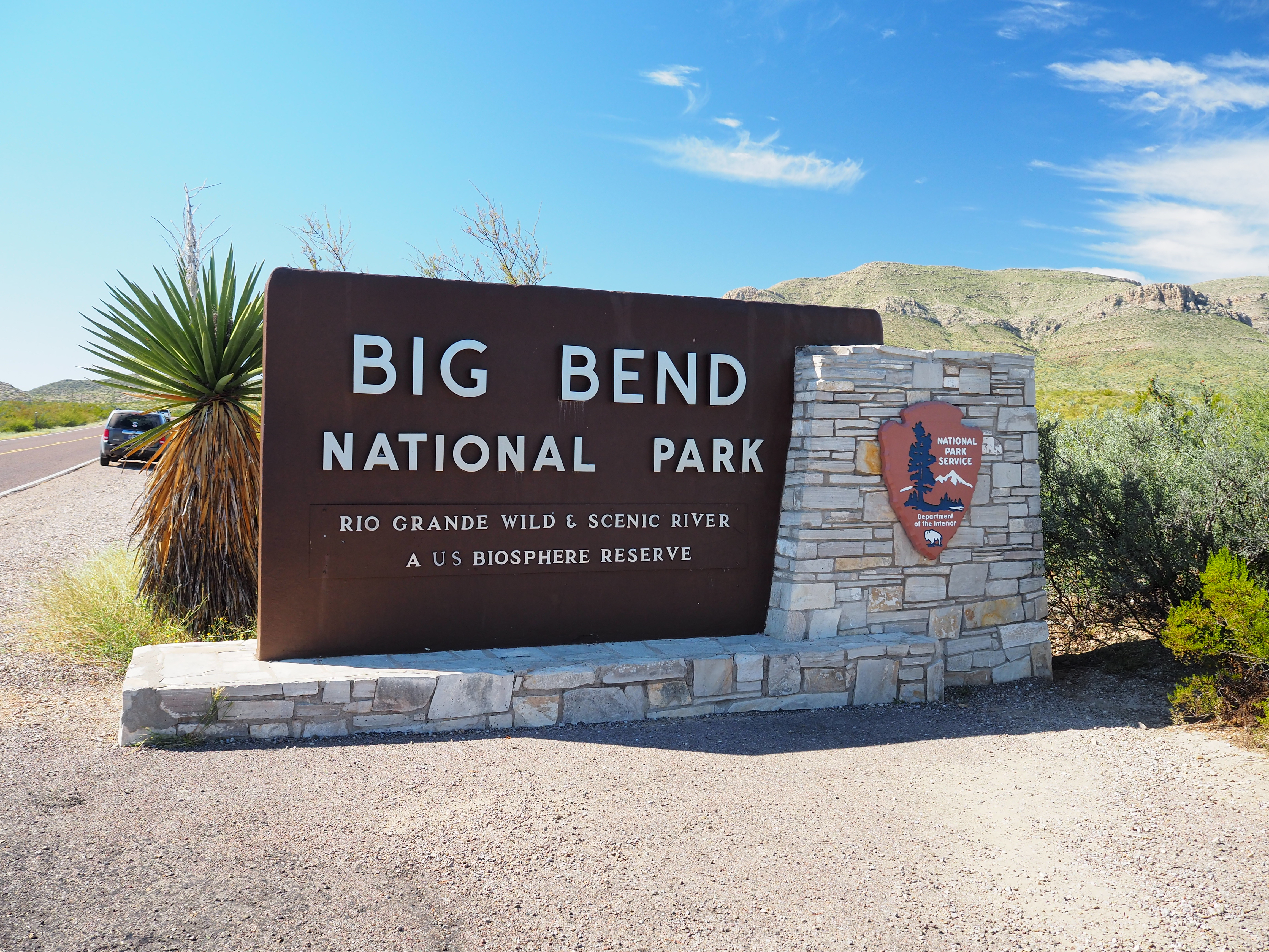
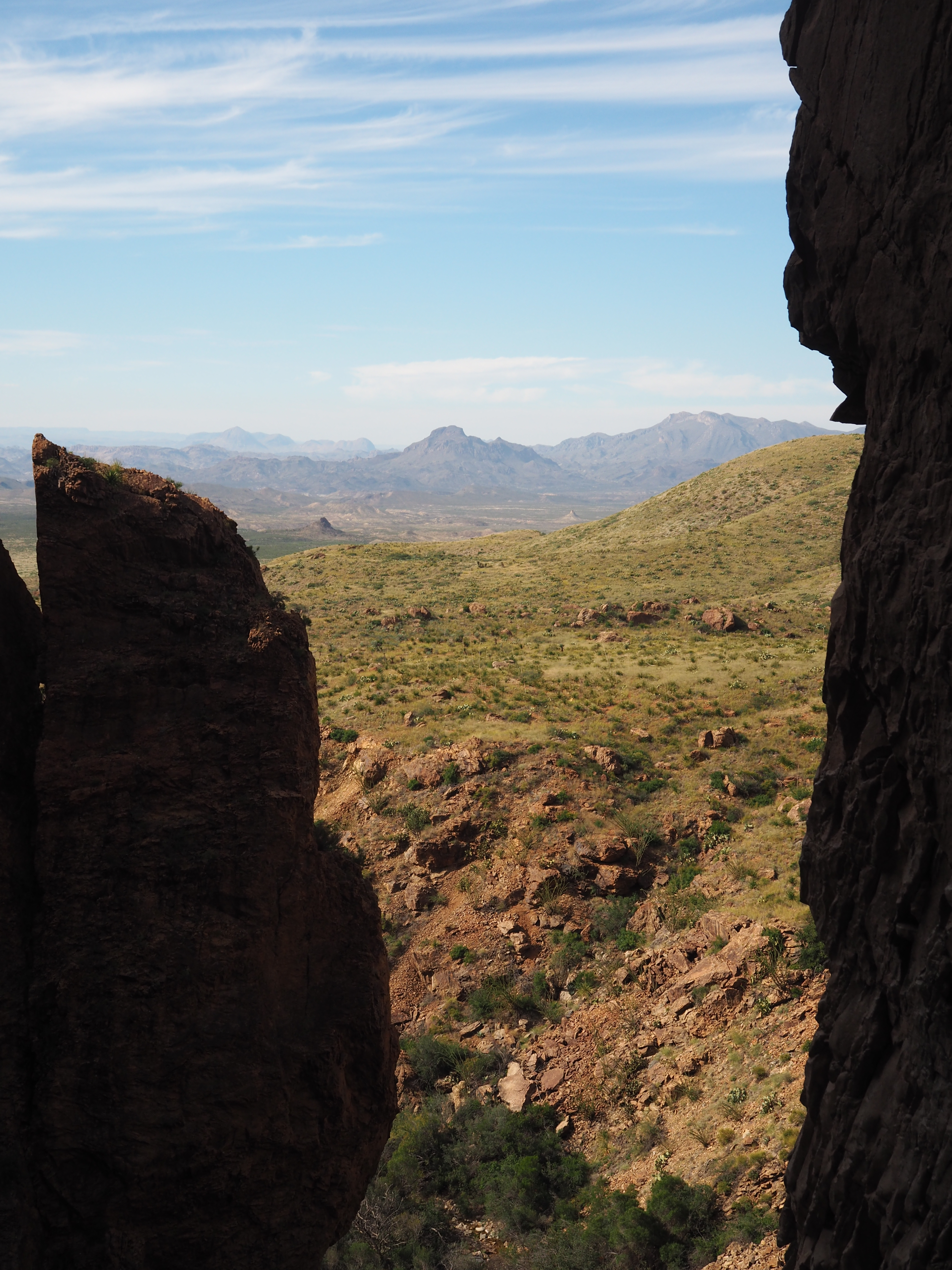
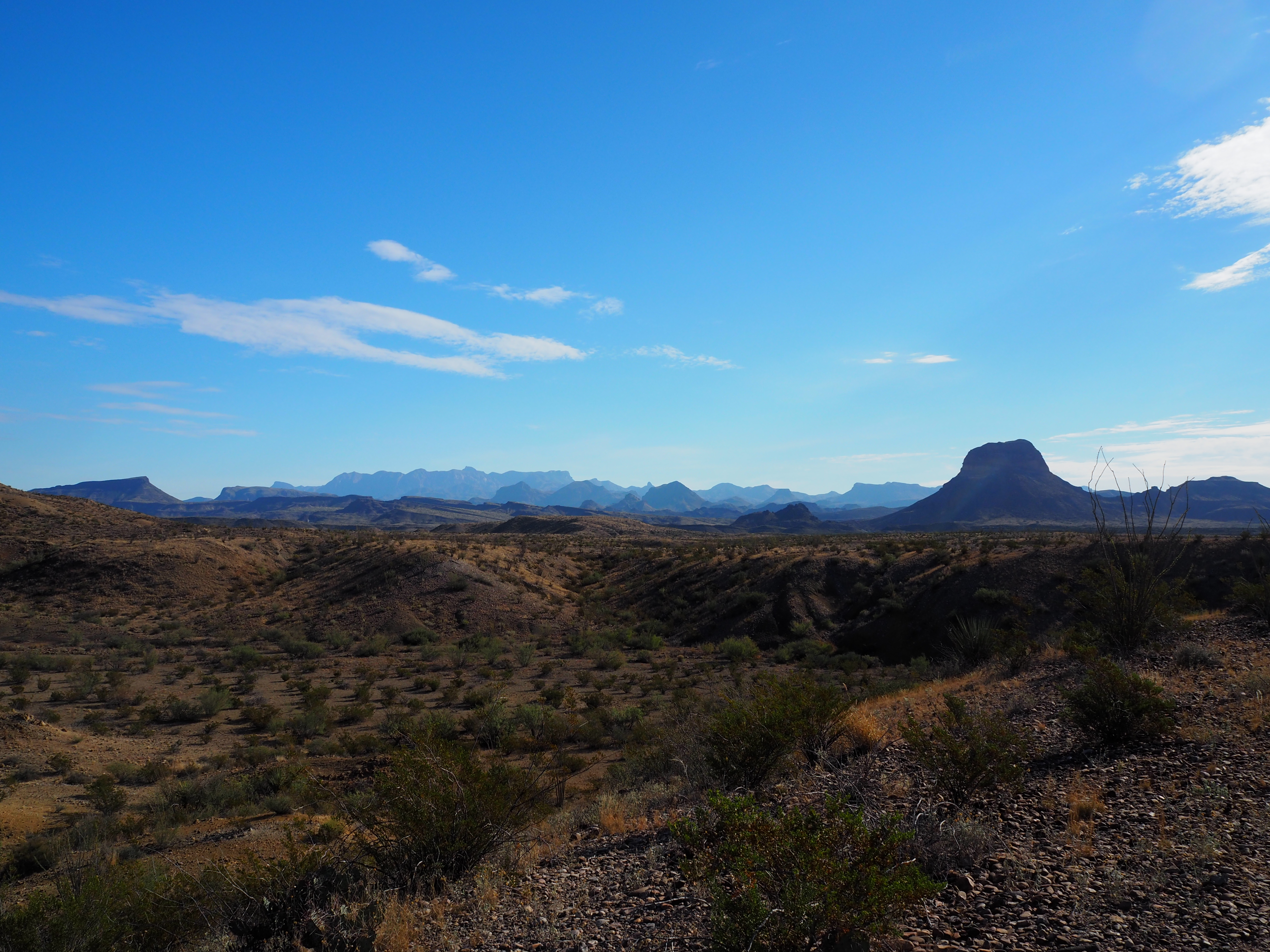
Over the weekend I took a roadtrip with 4 girlfriends to Big Bend National Park in far southwest Texas. I’ve lived in Texas over 20 years and have never made it out there. And it was long overdue. It is all that they say it is. Big, beautiful, rugged, inspiring, with mountain, desert and river views to die for.
We made it!
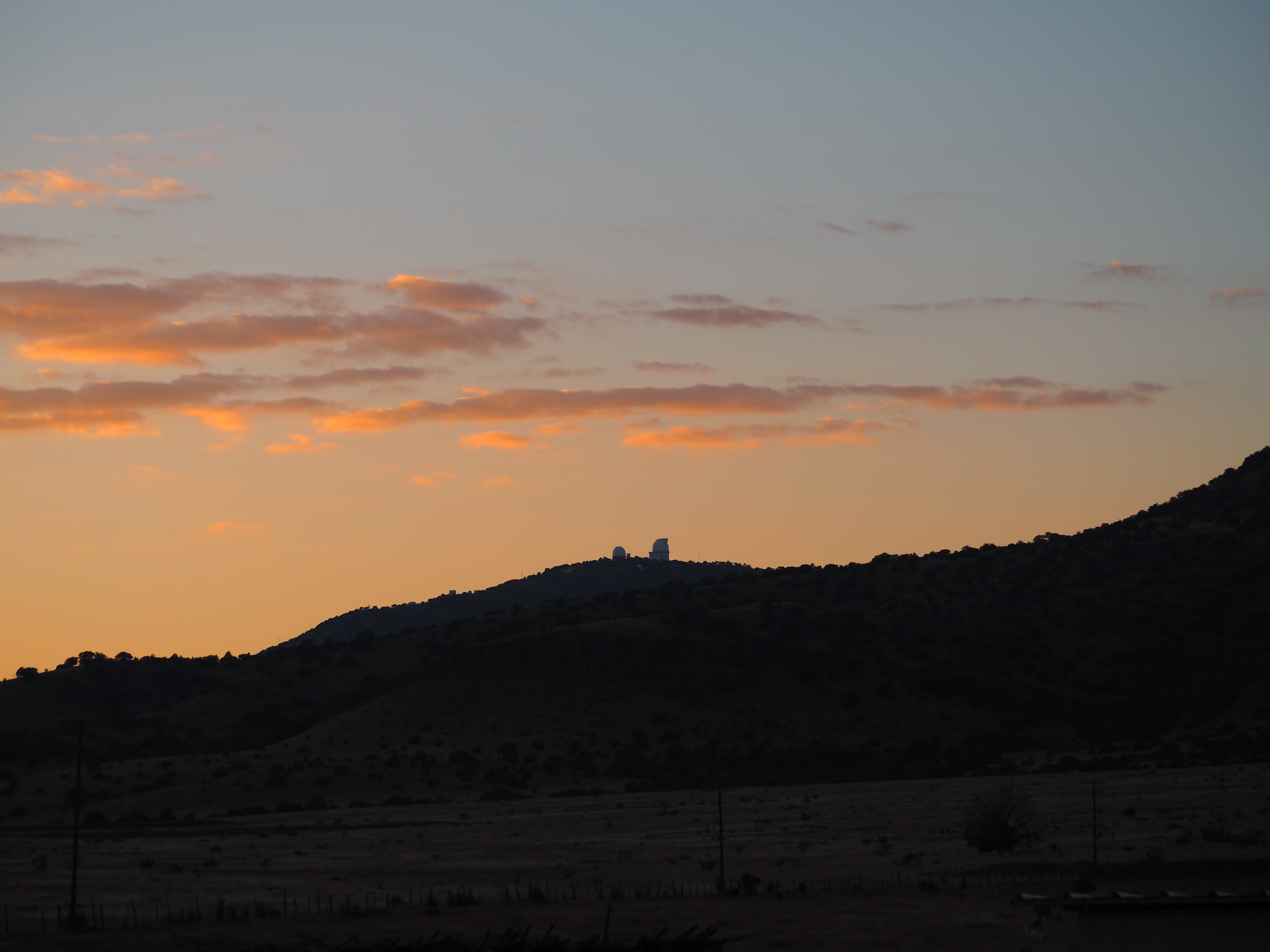
Six and a half hours by car from Austin, we made it to Ft. Davis by about 7pm Friday night. We had reservations to attend one of the evening Star Parties held 3 times a week at the University of Texas McDonald Observatory, and made it with a little time to spare. The skies were dark and the stars were out. The Milky Way was amazing. The stars and constellations visible to the naked eye were too many to count. Through the telescopes they had placed for visitors, I saw Saturn, the Andromeda Galaxy, M11 star cluster, and the 2 star clusters in the Perseus constellation. If you’re going to make the trip all the way out to Big Bend, you really should combine it with a trip to the observatory. Get tickets ahead of time online. They sell out frequently and have to turn people away.
McDonald Observatory giant telescopes on the hill – viewed from where we stayed outside of Fort Davis
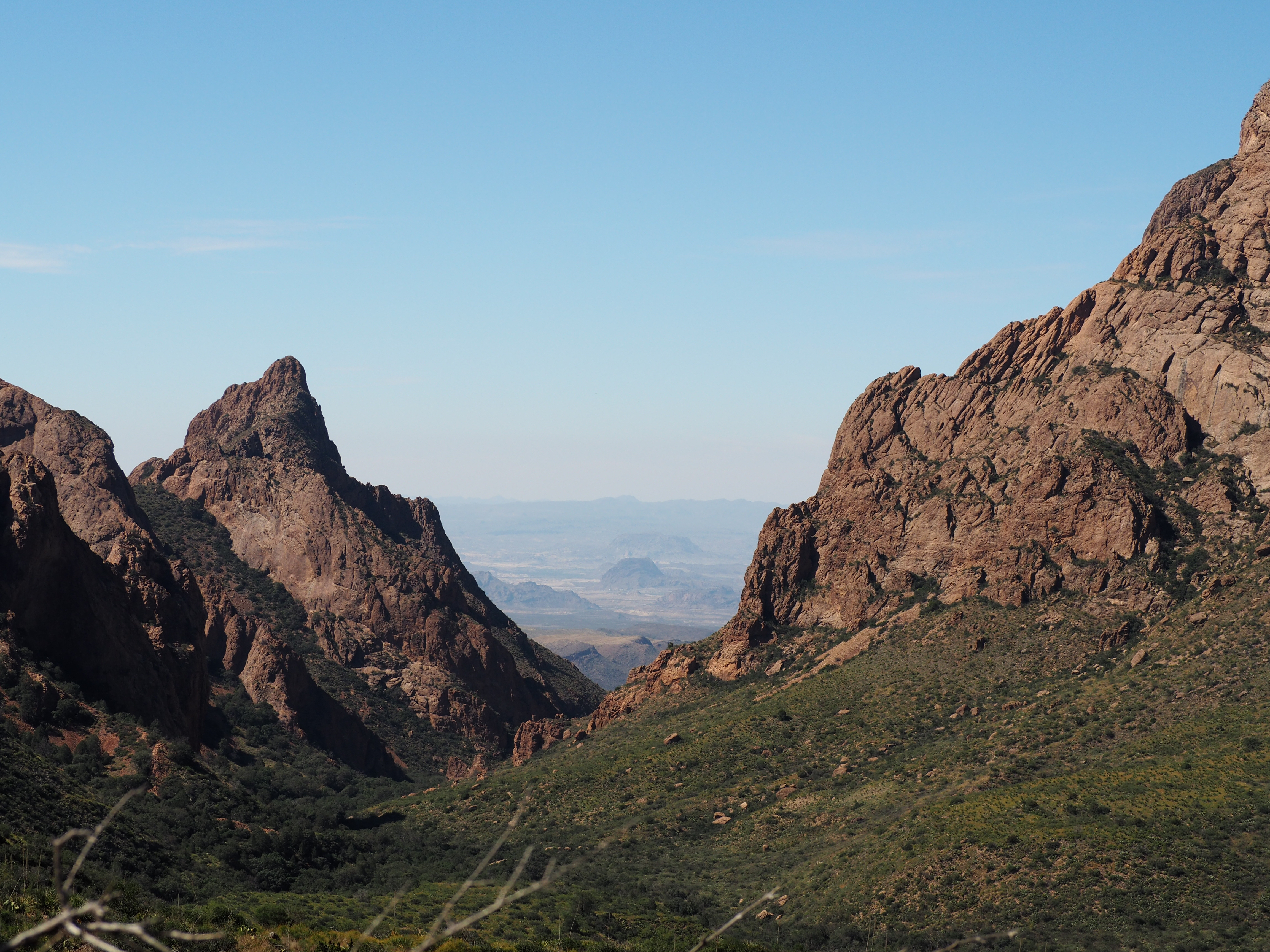
Saturday morning we drove to Big Bend and hiked inside of Big Bend National Park. Saturday afternoon we did the Window Trail – to experience the Chisos Mountains part of Big Bend. Four hours round trip, a moderately challenging hike, with breathtaking scenery all along the way.
The Window in the Chisos Mountains from the beginning of the Window Trail.
The Window view at the pour-off at the end of the trail. Watch your step!
We started Sunday at Santa Elena Canyon at dawn – to experience the Rio Grand river part of Big Bend. It was about an easy 2 hour hike roundtrip – though we had to bushwack a bit to get onto the trail. The Rio Grande has sliced a 1500′ deep canyon through the mountain there. At sunrise, the face of the sheer mountain walls glow in the brightening sunlight.
The Santa Elena Canyon trail, looking northeast with the sun rising over the Rio Grande.
About a mile and a half into the Santa Elena Canyon trail along the Rio Grande.
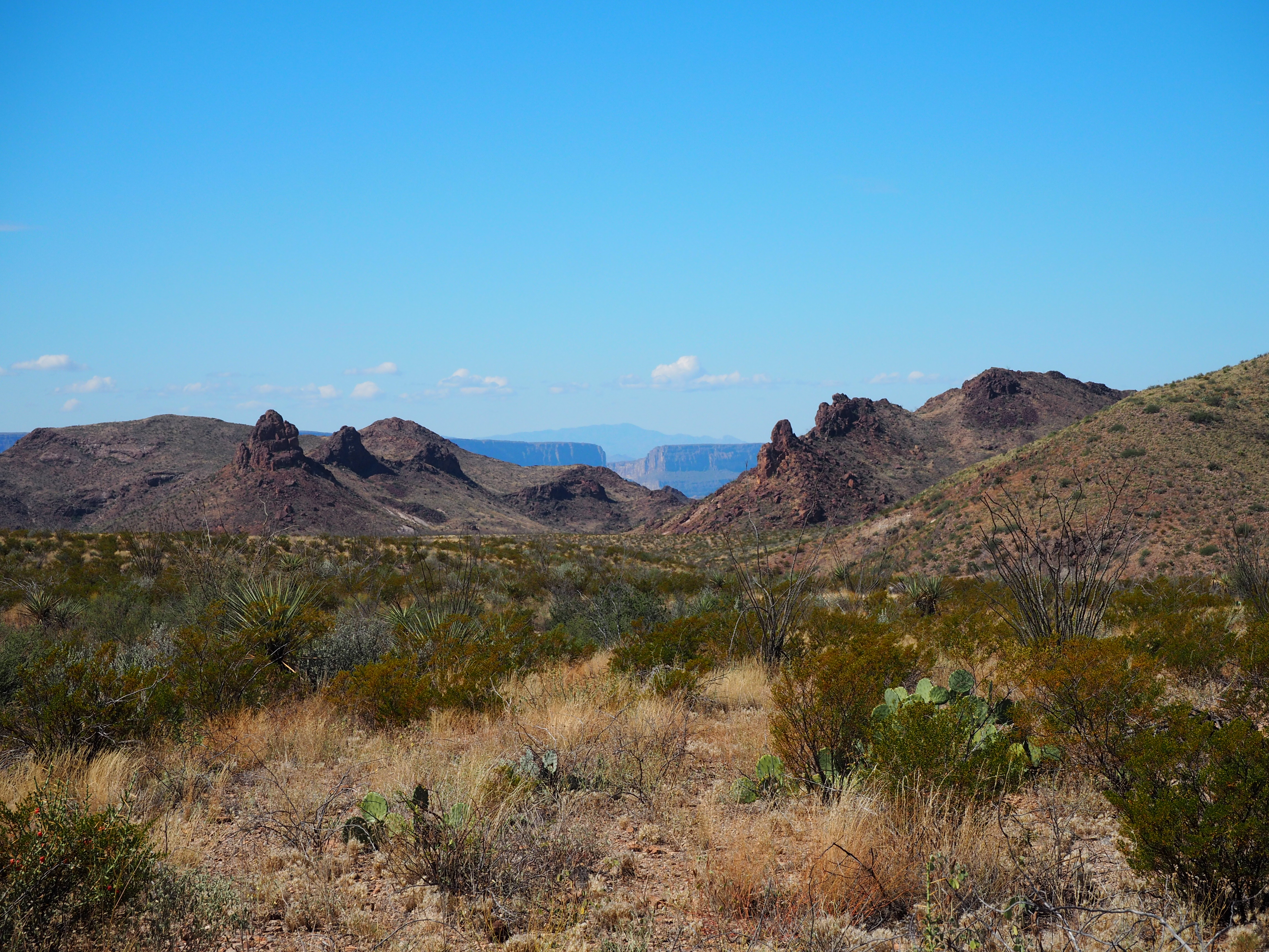
Sunday afternoon we hiked the Mule Ears Springs trail – to experience the Chihuahuan Desert part of Big Bend. A 3 hour hike, moderate difficulty, mainly due to the rough terrain and 90+ degree temperatures. Packing water with you is a must!
Mule Ears, in the distance on the left, from the Mule Ears Springs trail.
From the Mule Ears Springs trail, looking back south to Santa Elena Canyon in the distance.
Chihuahuan Desert scape, looking north to the mountains from the south side of the park.
Another very awesome trip. We hiked our butts off.
One of many familiar images of Austin is of the Pennybacker Bridge at Loop 360, overlooking a stretch of beautiful Lake Austin. The 360 Loop drive and its Hill Country views are one of my favorite parts of Austin. I crossed off one of my must-do’s by hiking up the cliff overlooking the bridge to take in the view for myself. In the panorama above, you can just see the downtown skyline peeking over the hill on the left of the image. I’m not afraid of heights, but I have to say my heart skipped a beat or two as I stood on the rock on the edge of the cliff.
For reference (from google streetview):
I think I like this shot better. It’s taken from a vantage point slightly farther west, down the trail along the top of the cliff.
Just another gorgeous day in my little corner of paradise.
Today we headed over to Noreen’s to celebrate Memorial Day. On the way we stopped by the cemetery to put a flag and flowers on Dad’s grave. Cheers, Dad!
We spent the day together: Noreen, Jared & Kelsey; Fran, Art, Rebecca, & Aaron (& Jojo); Colleen & Jake; Monte, Mom & me. Brian was down with the flu, so he and Gail will have to join us another time. It was another amazingly beautiful day in the Pacific Northwest when it was really supposed to be raining.
Jared and Kelsey cooked up the burgers & dogs, and we put out all the fixings; we also had halibut that Art caught just a day ago off the Washington coast. Delicious. Afterwards most of us headed down the road for a hike to the beach. Wow, that sure was steep! We found one of the 2 geocaches we searched for along the way.
This is a panarama, looking west to the Olympics, of the beautiful beach along Hood Canal at the bottom of our 1 mile, downhill, switchback-y hike. Becca and Aaron are skipping stones and Jojo is splashing around.
Then we turned around and slogged up the way we came down and were all extremely happy when we made it back to the upper trail head. Whew-ie!!