My friend, Lori, bought a new boat – a 45′ Island Packet, located in Florida. She wants to move it to Texas, so it will be nearby as she prepares this year to take it on long voyages up the east coast of the US and across the Caribbean. She asked if I’d help her bring it to Texas, and I said yes. So, last week, Lori, me, Monte and another friend, Joe, set out to bring her home. We are back home in Austin now. A summary of our adventure from my point of view follows… It’s a tad long, so read along as far as you like.

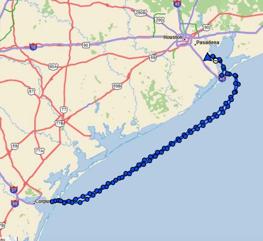
We had an amazing piece of technology with us – a Garmin InReach Explorer+ handheld device that uses satellite technology to send out our latitude & longitude every 10 minutes, and allowed us to receive and send text messages. Our friends and family could follow our progress via a web portal.
Monday – February 5: TX -> FL
We started out, by car, driving from Austin to Kemah, where we picked up our fourth crew member, and arranged for a slip for the boat when it arrived in Kemah. Then Lori rented a car that we’d drive one-way from Kemah to Florida. We took turns driving all the way through and made it to the boat by dawn the next day.
Tuesday – February 6
This boat is a high-end, blue water boat, in very good condition. During the marine survey, this boat was rated as “above average condition,” but even so, there was still a list of things to fix/adjust before we could set sail. After we arrived at the boat, we immediately went to work on that list, which kept us busy all day long for each of the next four days.
Must fix items:
- leak in the water heater
- leak in the generator exhaust inside the boat
- rudder post leak & clogged housing drain
- broken red/green navigation light
- repair tackle on boom vang
- (the REAL biggie) GPS Plotter / Radar non functional (we can’t leave without this getting fixed… AND we can’t fix it ourselves)
By the end of the first day, we went to bed feeling very down. We were tired and could not get many of the systems working. Couldn’t boot GPS plotter. We four seasoned sailors couldn’t even start the darn propane stove. We couldn’t figure out how to use the vacu-flush heads. We couldn’t get the generator started. UGH! At the end of the day, we made a store run – at least we’d figured out how to turn the fridge on…and the TV / DVD. So we sat down to drink some wine and watch Captain Ron, and turned in, exhausted, without dinner.
Wednesday – February 7
Wednesday morning was a new day. The Garmin guy showed up early and after a few hours said he’d fixed the problem. YAY! Right after he left, the same problem re-occurred. ARGH! He came back and gave us a workaround, enough to allow us to take the boat out on our shakedown cruise, and he’d come back the next day.
Also on Wednesday, the guy that did the original marine survey of the boat came back for the day. Lori had hired him for the day to walk us through the boat’s systems, and to accompany us on our shakedown cruise. This guy was awesome. If his fee was a million bucks it would have been worth it. After four hours he had walked us through how everything should work, fixed a few things, and lifted our spirits immensely. The sail was a nice one, in good wind. It was very good practice run, sailing a cutter-rigged sloop with electric winches; a little different to what we are used to. We pumped out the holding tank and filled the fuel tank. Afterwards, Lori took her back into the slip flawlessly, with bow-thrusters assisting.
Wednesday night we had a lovely dinner aboard, cooked on the now easy-to-light propane stove, and we watched Casablanca until we couldn’t keep our eyes open.
We felt 1000x better at the end of Wednesday. We have a boat that works, mostly, AND we can sail her smartly.
Thursday – February 8
Today was full of boat work. We each tackled one thing after another from the long boat prep list. We all worked hard all day long and celebrated with a nice dinner at the marina restaurant. The Garmin guy returned and brought the hoped-for cure-all: a new Garmin data cable to connect the master plotter in the cockpit to the slave plotter in the salon below. This is an apparently important detail, without which lots of data errors can occur, rendering sonar, plotter, autopilot, AIS and other important marine electronic components useless. We crossed our fingers… and the new cable appeared to address all the problems we had been experiencing. AWESOME!
Friday – February 9
Another busy day. Time is flying by. West Marine run for the final fix for the nav lights. Several grocery runs for provisioning. Cleaning boat. Refilling and sanitizing water tanks. The todo list is down to minor (we think) things. We declare tomorrow to be DEPARTURE DAY!
Saturday – February 10 – DEPARTURE DAY
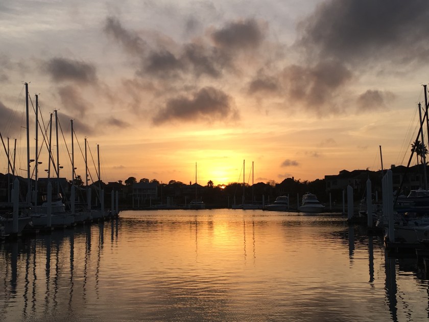
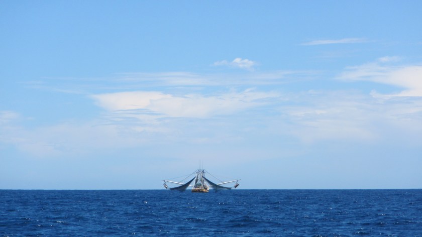
At 9AM sharp, Lori took the boat out of the slip, and we were off. The waters off Tampa Bay were shallow and full of many fisherman and crab pots. We had nice breezes as we left the channel and headed into the Gulf of Mexico for the first time.

As we proceeded to raise all 3 sails, the outhaul for the mast-furling main sail snapped. Those darn electric winches! No worries, though. Monte sewed the end of the old, broken outhaul to the end of a new one and with that, Joe easily threaded the new line through the blocks in the boom. Just a slight delay, and we were as good as new. Light chop made for a lovely sail. We buzzed along, motor sailing, at 7 knots.
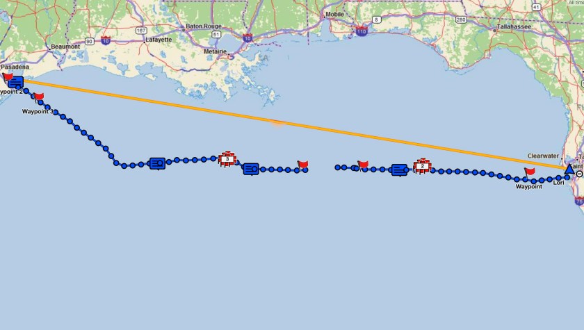
We plan to sail straight across. We have plotted a course using waypoints from a weather service that Lori enlisted. Sailing straight through means 24 hour watches. We are doing 3-hours-on / 3-hours-off 2-man crew shifts. Lori & I are paired up, and Monte and Joe are paired up. This kind of schedule leaves little time for anything other than trying to sleep when you are not on watch.
As the sun set on the first day, obscured by clouds on the horizon, Joe’s handline which we had been trailing behind us in the water had a big tuna on the end of it! He reeled it in and cleaned it on the deck.

Lori & I had brazenly cooked dinner for everyone after our 3-6pm shift. Later that night, the light chop turned into a relentless, grueling 3-6 foot southerly swell, given our western track. After midnight the winds picked up. This would continue for the next 30 some hours.
Overnight, as the wind was howling, the pressure on the rudder overloaded the autopilot, requiring hand-steering, making for difficultly maintaining our heading, and one less pair of hands to tend to the sails.
Sunday – February 11
By morning, it has become impossible to stand down below without being thrown about. The boat is a tank and there is no fear of her not being able to take it, but the bouncing and motion above and below decks is tiring. We each wear PFDs with a harness built in, using a 6 foot long tether to clip ourselves in while in the cockpit, and if we have to leave the cockpit to tend to rigging or other adjustments, we must clip ourselves to jacklines on the deck which have been strung bow to stern, to keep us from being thrown overboard.
Today the depth meter is over its limit, we are now in waters over 1000′ deep, and it doesn’t have that many digits.
In the afternoon, a friend of Joe’s sent a text on the InReach warning of a line of storms NW of us, moving SE. We were sure to run into it. And we did. From 4PM to 4AM the next day, we were dodging a dozen or so storm cells that lit up the radar in red. Rain pummelled us. Winds topped 30 knots (pretty much tropical storm strength). We rolled in the jib and prepared to bring in the main as well, as we proceeded south of Mississippi. We’ve started to see oil rigs on the horizon.
Monday – February 12
In the morning, the horrible pounding and smashing had subsided – for a while. We have been making good time though – over half way – and still have 3/4 tank of fuel. We celebrated the halfway point with our first beer underway.
As we sailed west into the afternoon, winds starting gusting over 40 knots, steady at 30 knots, with NNE swells. We were sailing through a Blue Norther! It was very rough above and below. At some point, Joe was thrown from his berth while asleep and smashed his face on the other side of the boat.
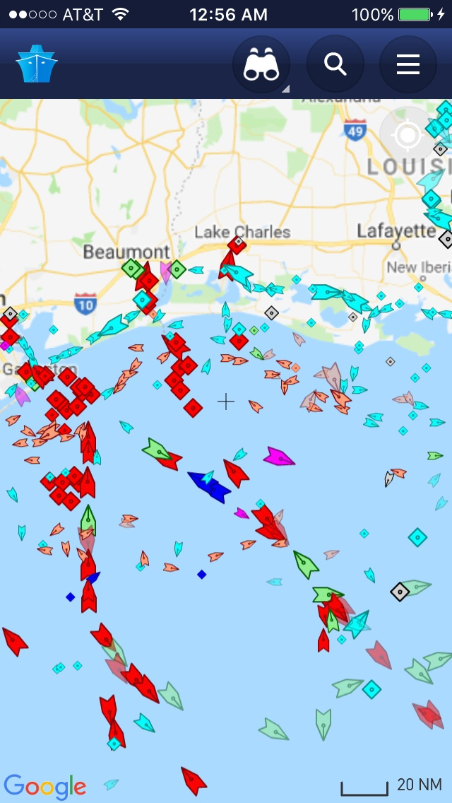
As we plodded ahead, we were surprised to see a 30′ fishing boat that did not show up on radar or AIS, directly ahead of us. We saw it about 200′ away and easily sailed around them as they waved hello to us, but we couldn’t help wondering what they were doing out here. Less than 5 minutes after that, we encountered our first close crossing with a tanker. He had the right-of-way, so we adjusted course to sail around his stern.
That night, we tiptoed through miles of oil rigs and freighters and submerged hazards. All eyes were on the instruments and dead ahead using the spot light to help us avoid dangers.
I have to say, it is challenging to process all the inputs – wind speed, radar blips, lights on the water, warning horns blowing, depth meter, in the dark, while encased in fog, with wind gusting around 20 knots, blasting through the waves at 8 knots – while weaving your way through. But there’s nothing like it!
After midnight the winds became calmer, and shifted more to the NE, making for a slightly kinder ride on our westerly track.
We are still getting used to the autopilot and GPS plotter. We had to be careful to keep adjusting our heading in the autopilot to maintain the desired heading over ground, or we’d find ourselves farther off course than we’d like to be. Somewhere south of New Orleans we got pretty close to shore and had to significantly correct our heading to get back on track.
Tuesday – February 13 – HAPPY MARDI GRAS!
This morning, FINALLY, the winds have dropped to 10-15 knots, and the swell has turned into a lovely following sea. I slept better than I have this whole trip. And the boat is calm enough to stand up below again.
We raised a Mardi Gras burgee on the flag halyard and donned our beads. We can actually cook again. Lori made breakfast. We had gumbo for lunch. Sauteed tuna appetizer. Spaghetti for dinner. We are starting to feel a tiny bit more normal.

During the afternoon a haggard and nearly exhausted Great Blue Heron made 4-5 attempts to land on the boat. He finally landed, bracing himself with his wings to stay onboard. We’ve named him Trigger.

While on night watch, Lori and I sailed across a shipping lane. We had 2 close crossings with giant tankers. They had the right of way in each case. One hailed us on the radio as we were listening to music on the iPad. It was a tad nervewracking deciding whether to pass in front of or behind each one. It depended on their distance, heading and speed relative to us. We made it though.
After dark we began passing through more fields of oil rigs. As of 3AM we were enveloped by a thick fog. It was bizarre listening to the fog whistles of the hazards as we sailed by. During the night we sailed into Texas waters. Trigger is still with us, now back on his feet.
Wednesday – February 14 – ARRIVAL DAY
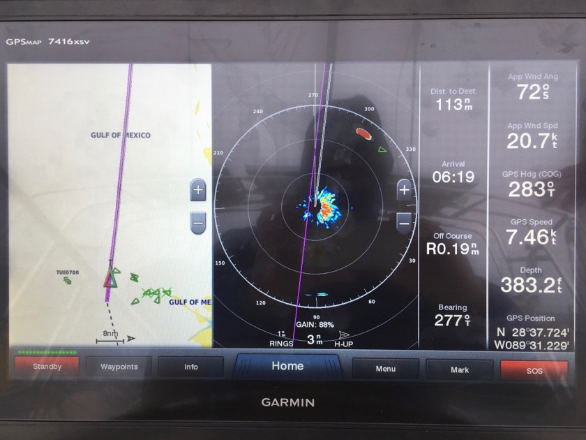
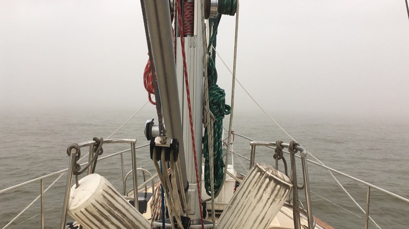
We are enveloped in a thick fog. We can see the bow of the boat, but that’s about it; ~50′ visibility. Before dawn, the autopilot stopped working again. Hand steering is tiring, so I gave Lori a rest until we got outside of our waypoint outside the Galveston ship channel. We are still passing oil rigs. We just can’t see them.
The radar tells us that we are passing dozens of tankers and freighters who have moored/anchored outside the ship channel, as we get close to it. We are just about the only boat moving. We arrive at our waypoint at about 8AM and decide to enter the channel. All hands are on deck, including Trigger, as Lori approaches the jetty.
Monte is at the nav station below, entering waypoints for our transit of the channel. Joe is in the cockpit with his laptop running OpenCPN, showing charts to Lori as she makes her way through the channel.
It is eerie to be completely unable to see the tankers anchored to our starboard, just outside the ship channel, and the boats leaving the channel, passing us to port, not 500′ away. We cannot see them with our eyes. But we can see them on AIS and on radar. We can hear them, and we feel their wake after they pass us.
As we pass the Galveston ferry route, we encounter and dodge 2 ferries. By 10Am the fog has lifted slightly. By now we are safely in. We can relax a bit. We just need to be patient for another 4 hours or so, as we navigate our way to Clear Lake to Kemah.
It’s amazing that Galveston Bay is only 7-ish feet deep. We draw 5 feet. Crazy.
Trigger bid us adieu as we crossed the bay. We pulled into the slip early afternoon on a low tide, with narry an inch of depth to spare. WE MADE IT!
This has been an important experience for me. I learned much. I went through many different emotions – excitement, nervousness, frustration, weariness, happiness, confidence building decision making, to name a few. It was amazing to be on the water, with no land in sight for days, in water a quarter of a mile deep, testing myself, while helping my friend bring her boat home.