
This morning my friend, Joe, set off as a crew member on a 46′ sailboat to help move her from Key West, Florida to Kemah, Texas. The boat has Garmin navigational equipment on-board, which means people can follow their progress via a garmin web portal. So I’m watching. And I’m wishing them fair winds and an uneventful crossing. Their current position is down by the blue arrow just off of Key West. The trip will be about 800 nautical miles, and I’d guess that depending on their average speed, it will take them 5-7 days.

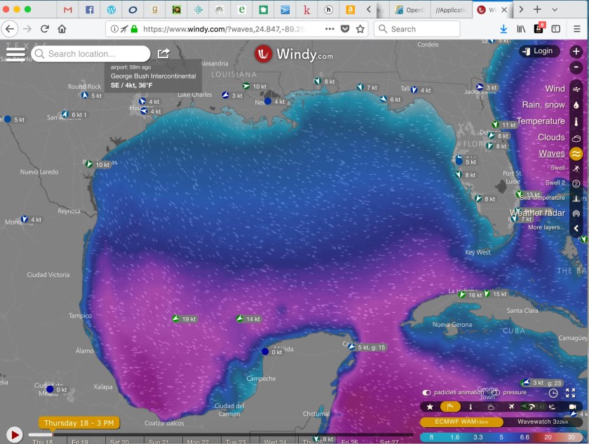
I am also watching the weather (wind speed, wave height, temps, etc) through a website called windy.com. The pinkish color below represents the current wave activity (10-20 foot seas) trailing the tail end of the cold front that moved through the southeast US this week. It looks like they timed their departure to just skirt north of that nasty stuff. I hope they see only blue or turquoise (6 foot seas or less) out there for the next 7 days or so.
I’ve also recently started using an open source chart plotter navigation program called OpenCPN. I’ve installed it on my Macbook, and have uploaded charts for the Gulf of Mexico. There are many obstructions and hazards out there; lit and unlit; above and below sea level; as well as a significant level of ship traffic.

Godspeed to Joe and all mariners out there.
